Falloway Geographical Office
| Falloway Geographical Office | |
|---|---|
 | |
| Agency Overview | |
| Formed | August 24, 2016 |
| Jurisdiction | Falloway City Council |
| Additional Information | |
| Location | City Hall, Falloway -6395 90 5180 |
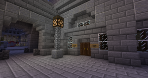
The Falloway Geographical Office is the national mapping agency for the city of Falloway. The office is located in the City Hall Complex, just off City Square, Falloway. The office has created a number of maps and theories and speculates on the New World's relative position in the Minecraft universe.
Discussions take place amongst members on the Talk Page on refining map details and naming of geographical features.
Universe Map
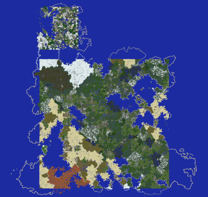
The Falloway Geographical Office has created a universal world map which positions the New World relative to the Old World. This map is not officially recognised by the server at this time but is recognised by Falloway and its city council. Other city governments can recognise this world map by using it freely in any application of their choice.
The mapping of the New World and Old World positions relative to each other is based on geographical studies on biome and ocean placements. The Falloway Geographical Office strongly believes that the New and Old worlds are two connected continents located within a larger world. Both the New World and Old World map data are taken directly from the Dynmap however additional land beyond the World Border is theorised.
There are many possible applications of this map including (but not limited to): airline route planning, marine traffic planning, cross-world territory claiming, etc.
Reasoning:
- The Old World is covered by a greater ratio of ice. While the New World has more ice, it is located towards the Northern half of the world while its Southern half contains more desert and mesa. Therefore the Old World was positioned above the New World.
- Both the Old World and New World have their largest Ocean on the West side, therefore it is presumed these two large oceans are connected.
- The Southern bay of the Old World aligns nicely with the North-East bay of the New World.
New World Region Map
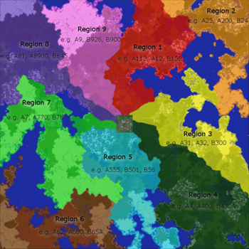
The region map (also known as the ward map) defines nine geographical regions in the New World. It was created by thomasfyfe who proposed it as a road numbering system for A and B roads during the Gamma Server discussions. The numbering system was approved as the official recognised numbering system.
The Vermilion Postcode System also adopted this map utilising it to define postcodes for towns and cities based on which ward they lie in.
Disclaimer
The Falloway Geographical Office is not server endorsed and does not hold exclusive rights over the mapping or naming of the MRT worlds. The Falloway Geographical Office is simply one avenue that players can choose to agree with or not agree with. The Falloway Geographical Office is run by thomasfyfe however input is taken into consideration from other users over on the talk page. The idea is to create at least one representation of how the MRT Universe looks and if it is recognised by a large amount of players then great. If you don't agree with it then nothing is stopping you from creating your own organisation that can host its own map and/or directory of geographical names.

