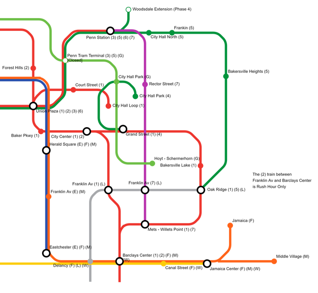
Bakersville IRT
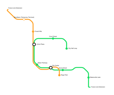
The Bakersville IRT is a metro system line run by the BTA that serves Bakersville. It was funded by FredTheTimeLord on November 26, 2016. Court Street and City Hall Station were the first stations built, creating the original route of the 1 Line. Soon, the original Bakers Street Station (Not to get confused with Bakers Avenue) was built, being a transfer from the classic 1 line to the newer 2 line. Bakers Street Station was renamed Union Plaza.
Colors and Lines
Each service is assigned a color. Within each color is a different line for the service, sort of like branches. The IRT uses a number system, while the BMT and IND use letters.
Station Guide
 Train
Train
| Status | Code | Station name | Connections |
|---|---|---|---|
| 1A | City Hall Loop | ZN9 Bakersville - Penn Station | |
| 2A | Court Street | Local | |
| 3A | Union Plaza | Transfer to | |
| AA | Baker Parkway | Local (Reroute of 5B) | |
| 4A | City Center | Transfer to | |
| 5A | Grand Street | Transfer to | |
| 6A | Bakersville Lake | Local | |
| 7A | Oak Ridge | Transfer to |
 Train
Train
 Train
Train
| Status | Code | Station name | Connections |
|---|---|---|---|
| 1C | Penn Station | Transfer to | |
| 2C | Union Plaza | Transfer to | |
| 3C | Park Ave | Transfer to | |
| 4C | Old Town | Local |
 Train
Train
| Status | Code | Station name | Connections |
|---|---|---|---|
| 1D | City Hall | Local | |
| 2D | Grand Street | Transfer to |
 Train
Train
 Train
Train
| Status | Code | Station name | Connections |
|---|---|---|---|
| 1F | City Hall North (under construction) | Transfer to | |
| 2F | Penn Station | Transfer to | |
| 3F | Park Ave | Transfer to | |
| 4F | 3 Av | Transfer to |
 Train
Train
| Status | Code | Station name | Connections |
|---|---|---|---|
| 1G | Penn Station | ||
| 2G | Rector Street | Transfer to | |
| 3G | South Bakersville (planned) | Local |
 Train
Train
| Status | Code | Station name | Connections |
|---|---|---|---|
| 1 | Penn Station | ||
| 2 | Rector Street | Local | |
| 3 | South Bakersville | Transfer to |
System Maps
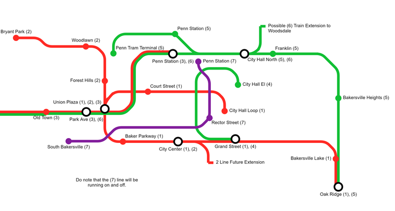
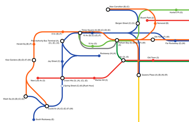
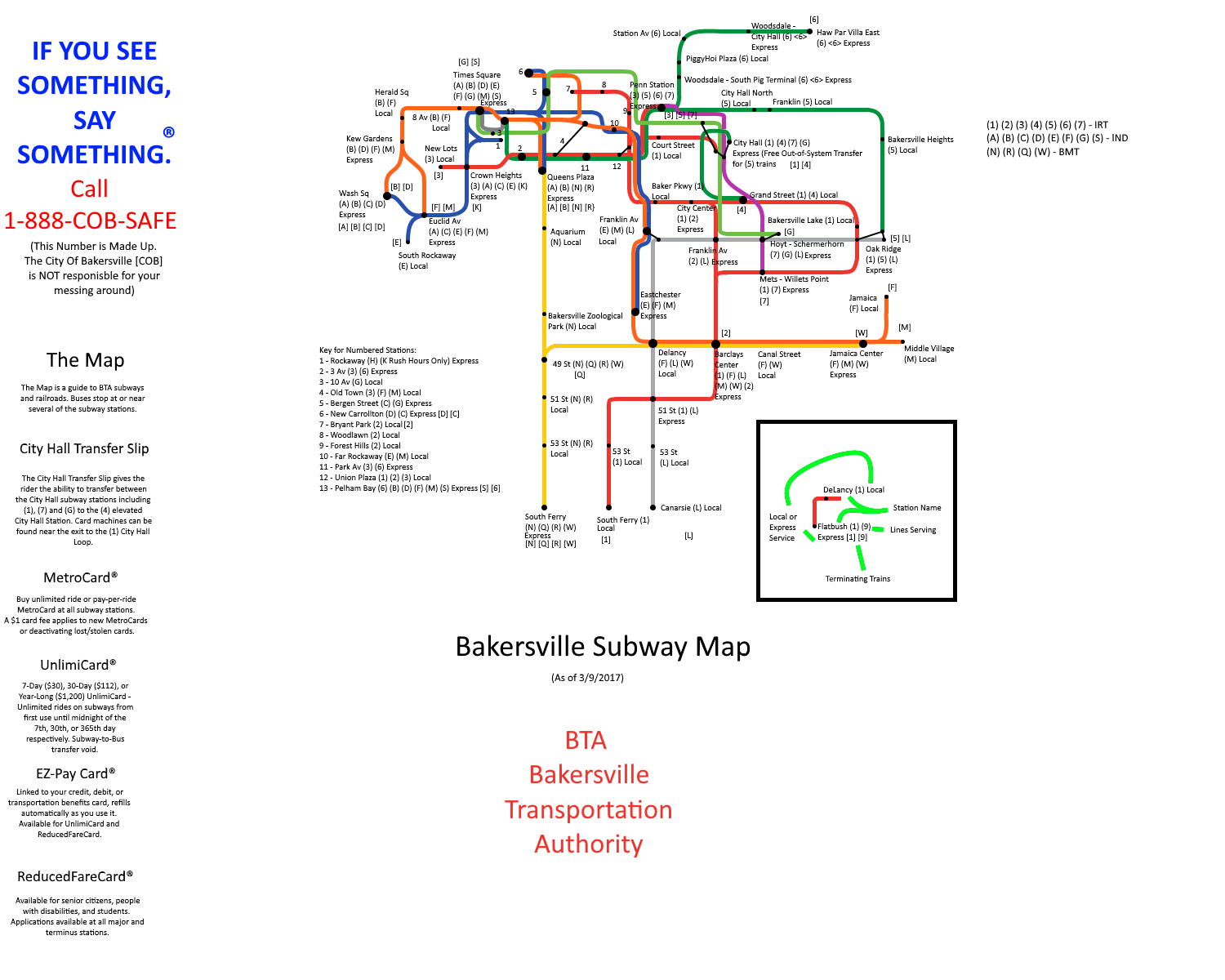
Throughout the system's history, the Bakersville Subway has had various different maps.
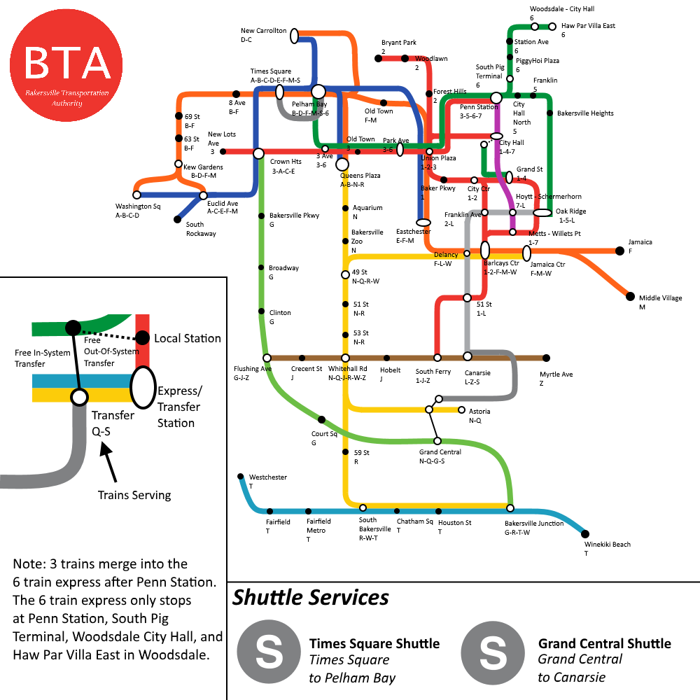
Current Up-To-Date Map
- All maps below are considered "Historical"
2016:
2017:
2/11/17:
3/9/17:
5/30/17
Bullets and Original Lines
Classic System
The classic IRT consisted of 2 lines, with different colors.
Revamp Era
The revamp era was the golden age of the IRT, and the first major upgrade to the system. It consisted of newer bullets based off the New York City Subway. The bullets are outdated, but have been conformed to be used for other town systems.
MTA Era
This is the most recent update of the bullet designs, following the ones of the MTA. They are used for the IND and IRT lines and will stay the same until all bullets are used.
Trivia
Abandoned Stations
City Hall Park
North of City Hall Loop is an unused station, the only station in the system to have been built and never opened. The present name plaques are inaccurate, as they should say "City Hall Park". The only street exit is an air shaft near the elevator to ZN9 Bakersville - Penn Station and the building for Court Street Subway Station. The station can be viewed by any ![]() train leaving City Hall Loop.
train leaving City Hall Loop.
