Canalways Project/Canal Clearances
This is a project managed by the MRT-Transit Discord. Before editing this page please request approval in the appropriate discord channels on the MRT-Transit Discord.
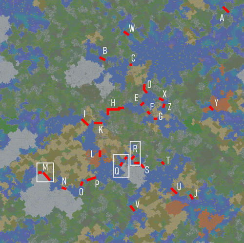
The Canal Clearances Page aims to offer a list of the clearances for use on existing canals. While currently there is no rules enforcing the need for ships to actually fit through canals, we offer this data about canals and connections between named bodies of water so boat lines who wish to are able to plan their routes realistically and for those managing projects passing over canals to be able to realistically pass over canals if they so desire.
* = Canal depth in Canals marked with a star in this table have a rounded bottom: Some ships with a draft shallower then this number might not physically fit depending on the shape of the hull.
** = Canal is blocked by a bridge or structure subject to removal or adjustment for blocking a waterway. The second value displays the clearances without accounting for this structure.
