Eastbourne
| Eastbourne | |
|---|---|
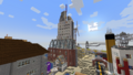
 Eastbourne from the Seafront. | |
 Flag of Eastbourne | |
| Officials | |
| Founder | OnyxCrow22 |
| Mayor | OnyxCrow22 |
| Deputy Mayor | Tadeusz09 |
| Town recognition | |
| Rank | [Senator] |
| Date founded | February 28 2021 |
| Date recognized as Councillor | August 6th 2023 |
| Date recognized as Mayor | September 27th 2023 |
| Date recognized as Senator | January 30th 2024 |
| Geography | |
| Town hall coordinates | 26273, 64, 19101 |
| World | New World |
| Ward(s) | Ward 3 |
| Region | Zeta |
| Transit | |
| MRT | SE39 Eastbourne |
| Road connections | B359 |
| Bus facilities | Transport for Eastbourne Buses |
| Rail facilities | Eastbourne Station (BluRail) Transport for Eastbourne Metro |
| Water transit facilities | Zeta Ferry |
| Landmark(s) | Natwick Tower |
| Language(s) | English |
| Population | 70 |
| Motto | The Oasis in the Sea of Desert |
Eastbourne is an senator city on the New World owned by OnyxCrow22.
Location
Eastbourne is located southeast of Mojangbahru, and northwest of Ellerton Fosby. The town is located west of the A 45 Carriageway and is connected by the B359. The road terminates at Eastbourne Roundabout, which sits above the A 45.
The town is located along the desert coastline and sits on a large peninsula. Eastbourne is currently on the northern part of the large peninsula.
The town is served by BluRail at Founder Square, and the MRT Southern Line at SE39, which is located a short walk from City Hall and Founder Square.
History
2021
- February 28th - Eastbourne is officially founded and construction begins on Founder Street. Construction of Eastbourne commenced on Founder Street, and the Founder House (since relocated) was the first building to be added. This was shortly followed by McDonald's and the Founder Square Apartment Complex. Hope Street and Bay Street began construction shortly after.
- Spring 2021 - Founder Square Suspension Bridge was constructed, but it did not connect anything at the time, as the East End Shopping District hadn't begun construction yet.
- Sometime in 2021 - The city remained disconnected from the MRT network for 2021, with no international or local transport connections available for Eastbourne citizens at the time.
Eastbourne Pier was also built, jutting out into the Coral Sea. The original pier contained some stalls, and a Dock at the end of the pier. At the same time, the Seafront District also saw construction, with the addition of two houses and a roundabout (since downgraded).
2022
- Mid October - Eastbourne stretched from Oasis Street to Hope Street.
- October 27th - First resident moves into the city, by purchasing a house on Oasis for $10.
- October 31st - Eastbourne is connected to the MRT Network for the first time by the B359
- November 19th - Eastbourne switches from USD to GBP as it's default currency.
- November 22nd - GBP as the currency comes into force. MRTD is still accepted as a currency in the city.
- November/December - Everett Estate is planned to be converted into a no-car zone, much to the fury of residents.
- Sometime in 2022 - City Hall opened it's first building on Falmouth Way, where it served as the main office from 2022 until June 2023.
2023
- January 2023 - East End Shopping Centre and Natwick Tower opens to the public. Natwick Tower surpasses Founder Square Apartment Complex to become the tallest building in the city.
- January 22nd - Eastbourne Town Council announced plans to expand Everett Estate.
- January 24th - Eastbourne Town Council overturns the no-car zone on Everett Estate, and reinstates the roads in the estate to cars again.
- January 25th - Everett Estate begins welcoming cars again.
- February 12th - Premier Inn opens its first branch in the East End District.
- February 13th - British Petroleum opens its first branch opposite the Premier Inn in the East End District.
- February 14th - Oasis Street is dissolved, and Founder Street is expanded up. New signs are built across the city with dot-matrix boards.
- February 24th - A joint venture between Eastbourne Town Council and the mayor of Rockville sees the connection of Rockville to the MRT Network via Eastbourne.
- February 25th - Eastbourne appoints its first deputy mayor. Eastbourne Town Council announces plans to change staircases to lifts. Many buildings saw lifts added.
- March 20th-26th May - Eastbourne falls silent, as the mayor goes offline for a Unity study.
- June 20th - Eastbourne Power opens its first wind turbine to the east of Natwick Tower. A new wind turbine is also announced, but was then cancelled.
Langley Estate is pushed back to September 2023, as the construction was slow. - June 21st - Eastbourne Town Council announces that the new extension to City Hall had topped out.
- June 23rd - 1 Malibu Close is demolished. New regulations are brought in about the minimum space required for a building.
- July 13th - Langley Estate opens to the public, two months ahead of schedule. Five new buildings are added to the town.
- July 18th - Founder Square Apartment Complex was completely furnished, with generic designs built across the floors.
Founder Square Police Station opens its doors to the public on Elizabeth II Road. - July 27th - The B-359 is declassified inside of Eastbourne's limits. A new motto was also unveiled on this day as well.
- July 29th - Eastbourne Town Council unveils a new flag that was implemented across the city.
Roundabouts on Oasis Street and Elizabeth II Road were downgraded on this day as well.
Eastbourne Road Association announces that the Michigan Avenue spur between Hope Street and Sussex Street was renamed to Elizabeth II Road. - July 30th - Transport for Eastbourne opens the Winchester Line metro line between the East End Shopping District and Founder Square, with the tunnel between City Hall and Founder Square under construction.
- July 31st - The Winchester Line extends to City Hall.
- August 1st - The Eastbourne Road Association is dissolved. Road management is placed under the responsibility of Transport for Eastbourne.
Eastbourne Health Trust announces a new Accident and Emergency Building, which is to be built at the Eastbourne Royal Hospital in the East End District.
Eastbourne Caverns are permanently closed on this day as well. - August 5th - The Eastbourne Ferry Terminal opens to the public.
- August 6th - Founder Square Suspension Bridge is demolished, and replaced with an arched bridge.
TfE announces a new bus service between the East End District to the Port of Eastbourne as part of the 1 Line. - August 7th-8th - TfE conducts construction work on eight ferry bays at the ferry terminal.
- August 8th - Eastbourne Town Council and Transport for Eastbourne announce Project Goliath, which aims to upgrade roads across Eastbourne, to allow for buses to pull over safely. Each road is placed into two categories.
- August 8th-14th - Roads across Eastbourne were upgraded.
- August 10th - The Winchester metro Line is upgraded to feature yellow lines and glass doors.
- August 11th - Eastbourne Royal Hospital's A&E unit opens to the public,
- August 13th - The East End Shopping Centre Multi-Storey Car Park is expanded.
- August 16th - Eastbourne Town Council renames Wickton and Northumber to Hexdale and Waterfront.
- August 17th-28th - Eastbourne falls silent for the second time, as Onyx was on holiday and watching the Eastbourne International Airshow.
- August 29th - Founder Square and City Hall metro stations on the Winchester Line were planned to be expanded to include shops and toilets.
- September 3rd - Work on the expansion of the two stations finished on this day.
The East End District bus stop on the 1 bus line is relocated to be outside the shopping centre. - September 6th - Eastbourne Health Trust acquires a new site from Eastbourne Town Council for an undisclosed amount of money.
- September 7th - The old Eastbourne Royal Hospital site was demolished.
Premier Inn unveiled a new design for their hotels. - September 8th - Eastbourne Royal Hospital reopens across the lake from the original site.
- September 19th - Eastbourne Town Council announces a new plan for a library to be constructed on Hope Street. The old bookshop closes, and is demolished. It is later replaced by a sunken plaza.
- Sometime between September 9th-18th - Winslow Estate opens on the former site of Eastbourne Royal Hospital.
- October 9th - Michigan Avenue is downgraded to a 2-laned road from a dual carriageway. A new bus stop was constructed on the westbound side of the road, and a new footbridge was added in.
- October 12th - A new roundabout was built on the Michigan Avenue x Charleston Street junction. Another roundabout was also constructed in the southern part of the town, to connect to the future Port of Eastbourne.
- October 26th - Hexdale Roundabout is demolished, and replaced with a dual carriageway and junction.
- October 29th - Montgomery Roundabout and Turtle Roundabouts were upgraded to add in slip lanes on each exit and entrance. Cargo Terminal Roundabout had a slip road demolished from the roundabout itself, and had a new slip road installed further north of the roundabout.
- October 30th - Eastbourne Town Council announces Project Aquarius, which is the plan to upgrade Eastbourne Pier.
Junction One of the Hexdale Expressway is downgraded to slip roads. A new slip lane was added for the Hospital Services exit. - October 31st - Planning begins for the upgrades for Eastbourne Pier.
- November 6th - The Winchester Line is planned to extend to Eastbourne Royal Hospital by TfE.
- November 11th - Eastbourne Pier upgraded in its first phase.
- November 14th - Eastbourne Pier went into the next phase of its upgrades.
- November 26th - The newly upgraded Eastbourne Pier reopens to the public.
Excavation work on Eastbourne Royal Hospital metro station starts. - December 2nd - A Christmas tree was installed near the BluRail Station.
Tunneling to Eastbourne Royal Hospital continued, with the addition of corners. - December 4th - East End Florist opens in the East End Shopping Centre
Tunnelling works on the tunnel to Eastbourne Royal Hospital finishes on this day. Eastbourne Royal Hospital metro station opens with limited accessibility. - December 5th-13th - Eastbourne Royal Hospital metro station continues construction.
- December 16th - Northumber Road is renamed to Everett Road.
Cargo Terminal Roundabout's northern slip lane is adjusted to go over the roundabout
Founder Street is extended further south.
The first walls of Magnolia Heights begins to be laid down. - December 18th - Traincart compatibility is added to the Winchester Line, with the removal of glass doors on the platforms.
- December 19th - Eastbourne Royal Hospital metro station completes construction.
A new metro entrance to the station is built as well. - December 20th - Construction begins on Magnolia Heights.
- December 21st - Harvant Square Road Tunnel is renamed to Waterfront Road Tunnel.
- December 22nd - Upgrades complete on the Waterfront Road Tunnel.
New entrances for the Founder Square metro station are installed on the same day. - December 23rd - City Hall metro station opens two new entrances for the station, and the Waterfront Road Tunnel had emergency exits installed in the tunnel.
- December 26th - Magnolia Heights completes, and opens to the public.
The Rockville Turnpike was altered, with the addition of slip lanes in the direction of Rockville, and a re-alignment of the Eastbourne bound side of the Turnpike to Founder Street.
Construction begins on the Eastbourne Bus Station. - December 27th-31st - Eastbourne Bus Station continues construction.
- December 31st - Eastbourne Bus Station completes construction, and opens to the public.
2024
2024 started off with the relocation of McDonald's on Founder Street to be one block further back.
- January 2nd-5th - Founder Square Flyover is demolished from Elizabeth II Road to Lewes Street.
Founder Square Apartment Complex Lobby is upgraded. - January 5th - Natwick Tower receives renovations for a bigger roof. New flags of the Union Jack and the flag of Eastbourne are added.
- January 6th - The Christmas Tree on Oasis Street is chopped down. Michigan Avenue and the Hexdale Expressway past Junction One are closed indefinitely.
- January 7th - Founder Square Apartment Complex's staircases are demolished and rebuilt.
Premier Inn closes its north wing pool and bar, and relocates them to the main roof instead. The bar renames from Nashville Bar to Honolani Bar.
TfE announces that the Founder Square Arched Bridge is demolished, and replaced with a seawall.
Plans are proposed for a brand new building for the Vehicle Registration Bureau in the East End District. - January 12th - City Hall closes to the public for renovations.
- January 13th - TfE announces that a new car park has been installed outside the Eastbourne Ferry Terminal building.
Eastbourne Customs Building closes for renovations. - January 14th - The VRB office in the East End District completes construction and opens to the public.
A new roundabout is constructed in the Port area of the city.
A new turn-around road is constructed on Montgomery Road.
Eastbourne Cable Bridge is constructed between Eastbourne Traincart station and Michigan Avenue by AP_Red. - January 15th - Founder Square Library opens a new garden to the public.
Hope Street between City Hall and Elizabeth II Road is downgraded to slip lanes. - January 16th - Upgrades are carried out on the Hexdale Expressway, with new signs that have dot matrix boards installed along the expressway.
Eastbourne Customs building completes renovations, and reopens to the public. - January 18th - City Hall completes renovations, and reopens to the public.
- January 19th - City Hall's Falmouth-Main Complex corridor is demolished and replaced with a skybridge.
- January 20th - TfE rebrands the DVLA to VRB.
Marks and Spencer completes upgrades, and reopens to the public. - January 21st - Port Street is permanently closed to motor traffic.
- January 22nd - The Rockville Turnpike is demolished and replaced with Sussex Roundabout.
Founder Street is pulled back to the Montgomery Tunnel.
Montgomery Road was upgraded to Magnolia Roundabout.
The slip lanes on Everett Roundabout are demolished, and a new slip lane is added to the roundabout heading southbound.
the Port Authority of Eastbourne announces that their headquarters would be expanding further south.
The pedestrian tunnel on Elizabeth II Road is demolished, and replaced with a walkway.
The road into the police station is upgraded. - January 23rd - One Montgomery Road begins construction.
- January 24th-25th - Magnolia Roundabout is demolished, and replaced with slip lanes that never connect to Montgomery Road.
Everett and Montgomery roundabouts are upgraded, with a larger roundabout built for each one.
Hospital Roundabout is earmarked for demolition. - January 26th - Hospital Roundabout is demolished and replaced with a four way junction.
A new roundabout is planned to be constructed on Charleston Street to connect Hospital Services.
A new arched bridge is constructed on Michigan Avenue.
The Founder Square Flyover is completely demolished. - January 27th - Construction begins on Hilltop Roundabout.
A new suspension bridge is constructed on the site of the flyover.
One Montgomery Road completes construction, and opens to the public. - January 30th - Eastbourne is promoted to Senator.
Eastbourne City Council announces a new project called Project Orion, which aims to improve the city, and reconstruct parts of it.
The entrance to Everett Estate was moved further east, and the old road was closed.
Elizabeth II Road was re-routed around the site of the bus station. - January 31st-February 2nd - Roads across Founder Square are upgraded to wider roads.
A new proposed skyscraper was increased from 20 m, to 50 m high. - February 3rd - East End Shopping Centre Car Park's extension is demolished, as is East End Electronics.
The East End District bus stop on the 1 Line is relocated to Shopping Lane. - February 4th - The bus stop is relocated again to its permanent home on Oasis Street.
New on-street parking was installed on the street.
Chiswick Tower begins construction.
Wilko moves from the East End Shopping Centre to Chiswick Tower, and the Wilko extension is demolished. - February 5th - Construction continues on Chiswick Tower.
Montgomery Road is re-routed to avoid going through a tunnel.
Coastline Estate road network is expanded.
The Port of Eastbourne tunnel is lowered down a block. - February 6th - Chiswick Tower nears completion.
The Port Authority of Eastbourne announces a completely new imagining for the Port of Eastbourne. - February 7th - Chiswick Tower completes construction, and opens to the public.
- February 11th - Everett Estate is declared complete, with the addition of a final house.
Planning works begin for a new conference hall and clock tower in the Royal Hospital area of the city. - February 12th - Construction completes on the Eastbourne Conference Hall Clock Tower.
The Eastbourne Conference Hall tops out on this day as well. - February 13th - Eastbourne Conference Hall completes construction and opens to the public.
A new extension of Eastbourne Royal Hospital begins construction. - February 17th - The Winchelsea Building of the Eastbourne Royal Hospital tops out.
- February 21st - Eastbourne Royal Hospital's Winchelsea Building is partially opened on the ground floor.
- February 24th - The first floor of the Winchelsea Building at ERH completes and opens to the public.
Geography
Climate
Due to Eastbourne being in a desert, it experiences high temperatures all year long during the day, and low temperatures at night in the winter months.
Due to being in a desert, Eastbourne experiences low rainfall in a year, making the region unsuitable for agriculture on the surface. Eastbourne in the summer often experiences 35 °c, with highs of 40 °c. Sometimes, warm air from the Coral Sea causes storms to form, which causes excess rainfall to fall on a dry region of land.
Below is a table of the temperatures in Eastbourne, with average and record both included.
| Climate data for Eastbourne | |||||||||||||
|---|---|---|---|---|---|---|---|---|---|---|---|---|---|
| Month | Jan | Feb | Mar | Apr | May | Jun | Jul | Aug | Sep | Oct | Nov | Dec | Year |
| Record high °C (°F) | 32 (90) |
33 (91) |
36 (97) |
36 (97) |
38 (100) |
40 (104) |
43 (109) |
47 (117) |
45 (113) |
42 (108) |
30 (86) |
26 (79) |
47 (117) |
| Average high °C (°F) | 26 (79) |
27 (81) |
27 (81) |
30 (86) |
32 (90) |
34 (93) |
36 (97) |
40 (104) |
34 (93) |
30 (86) |
28 (82) |
24 (75) |
30.6 (87.1) |
| Daily mean °C (°F) | 23 (73) |
24 (75) |
24 (75) |
27 (81) |
29 (84) |
31 (88) |
33 (91) |
37 (99) |
31 (88) |
27 (81) |
25 (77) |
21 (70) |
27.6 (81.7) |
| Average low °C (°F) | −1 (30) |
1 (34) |
4 (39) |
13 (55) |
16 (61) |
20 (68) |
23 (73) |
26 (79) |
24 (75) |
22 (72) |
6 (43) |
2 (36) |
13 (55) |
| Record low °C (°F) | −11 (12) |
−9 (16) |
−6 (21) |
3 (37) |
6 (43) |
10 (50) |
13 (55) |
16 (61) |
14 (57) |
12 (54) |
−4 (25) |
−8 (18) |
−11 (12) |
| Source: Eastbourne Meteorological Weather Service (EMWS) | |||||||||||||
Transport
Below is a list of different transport options (including expressways), that are available in the city:
Roads
| Name | Terminus A | Terminus B | Category | Notes |
|---|---|---|---|---|
| Oasis Street | Seafront, Founder Square | B359, at Langley Estate | A | Unofficially continues as part of the B 359 to Eastbourne Roundabout. |
| Avondale Road | East End Shopping Centre | Winslow Estate, East End District | A (B in the Winslow Estate) | Renamed to Shopping Lane, and rerouted. |
| Roseberry Road | B359 | Compton Close, Langley Estate | A | Formely known as Harvant Road. Renamed to Ashwood Close. |
| Compton Close | Roseberry Road | N/A | A | Now known as Hazelwood Close |
| Founder Street | Hope Street, Founder Square | Everett Road Junction | A | Temporary Terminus |
| Hope Street | Founder Street, Founder Square | Port Roundabout | A | Temporary Terminus |
| Elizabeth II Road | Ferry Terminal | Sussex Street, Founder Square | A | Terminus is a car-park at the western end of the road. |
| Sussex Street | City Hall | Sussex Roundabout | A | Temporary Terminus, does not serve as part of the Eastbourne-Rockville Link. |
| Everett Road | Ferry Terminal Roundabout | Montgomery Tunnel | A | Everett Estate terminus closed and replaced with slip roads on Elizabeth II Road. |
| Malibu Close | N/A | Everett Road | B | Terminates before leaving Everett Estate. |
| Northampton Close | Malibu Close | N/A | A | Reinstated as a official road |
| Port Street | Hope Street | Everett Road | A | No longer exists, it is now pedestriansed |
| Lewes Street | Sussex Street | Magnolia Heights | A | Renamed to Lewes Road. |
| Montgomery Road | Montgomery Roundabout | Port of Eastbourne Junction | A | Unofficially continues as part of the Hexdale Expressway. |
| Charleston Street | N/A | Hilltop Roundabout | A | Temporary Terminus southbound. |
| Michigan Avenue | Harvant Square Road Tunnel, Founder Square | Hexdale Link Junction | A | Harvant Square Road Tunnel is now Waterfront Road Tunnel. |
| Arundel Walk | Kensington Close, Magnolia Heights | N/A | C | No longer exists, too small for a road. |
| Windsor Close | Kensington Close, Magnolia Heights | Lewes Road, Magnolia Heights | C | No longer exists, too small for a road. |
| Kensington Close | Magnolia Heights | N/A | A | No termini, goes from house to house. |
| Falmouth Way | Founder Street, Founder Square | Hope Street, Founder Square | N/A | Pedestrianised walkway, not open to traffic. |
| Magnolia Walk | Hope Street, Founder Square | Substation A1, Founder Square | N/A | Pedestrianised walkway, no traffic allowed. |
Hexdale Expressway
Below is a list of exits that are on the Hexdale Expressway:
| Status | Exit number | Destinations | Road designation | Notes |
|---|---|---|---|---|
| 1a | Eastbourne (C), Waterfront, Port of Eastbourne | Montgomery Roundabout | Not officially a junction, but instead classed as a roundabout. | |
| 1/1b | Eastbourne Royal Hospital, Hexdale (W) | Charleston Street | First full junction in the city. | |
| 2 | Hexdale (C) (closed) | Hexdale Link | Partially demolished. | |
| 3 | TBD (planned) | TBD | Long term. |
Ferries
Eastbourne has a dedicated ferry terminal, where ferries can dock, and provide connections to different corners of the MRT. To see the ferry terminal page, please go to this link: Eastbourne Ferry Terminal.
Buses
Eastbourne has a dedicated bus station, where buses can be parked, and provide connections to areas around the MRT. To see the bus station page, please go to this link: Eastbourne Bus Station.
Eastbourne Metro system
The Eastbourne Metro System is a series of metro lines that link up the city to the various districts that are inside of Eastbourne. Each line is listed below, with each station also listed.
Winchester Line
The Winchester Line consists of these stations:
| Status | Code | Station name | Connections |
|---|---|---|---|
| EESC | East End Shopping Centre | None | |
| F.SQUARE | Founder Square | None | |
| E'BOURNECH | City Hall | None | |
| ERH | Eastbourne Royal Hospital | None | |
| HDW | Hexdale West (planned) | None | |
| CHD | Central Hexdale (planned) | None |
Tallest buildings and structures
Here is a list of the tallest buildings and structures in the city:
All heights are calculated using /depth ingame, or using the y-coordinates on a minimap, then the height of the building or structure is found by subtracting the difference between the top and bottom.
Not every building and structure in the city will be tallied, as some are too low to be tallied (minimum height for tallying is 18 m)
| Name | Location | Height (in metres) | Spire height | Notes |
|---|---|---|---|---|
| Natwick Tower | East End Shopping District | 83 m | 107 m | Current tallest building in the city. Tallest building in the East End District. |
| Founder Square Apartment Complex | Founder Street, Founder Square | 48 m | N/A | Tallest building in the city from February 2021-January 2023. Tallest building in the Founder Square District. |
| Wind Turbine HN/24H | B 359, outside of Coastline Estate | 39 m | N/A | Current Tallest structure in the city. |
| Eastbourne Royal Hospital Chimney | Michigan Avenue, Eastbourne Royal Hospital | 33 m | N/A | Height increased by 3 m during relocation from the East End District. |
| East End Shopping Centre | East End Shopping District | 32 m | N/A | |
| Eastbourne Cable Bridge | Between East End District and Hexdale | 31 m | N/A | Tallest railway bridge in the city, built by AP_Red as part of the Ellerton Fosby to Nuuk Traincart Railway. |
| Chiswick Tower | Shopping Lane, East End District | 30 m | N/A | Second tallest high-rise in the East End District. |
| City Hall Falmouth Complex | Falmouth Way, Founder Square | 27 m | N/A | |
| Eastbourne Ferry Terminal | Elizabeth II Road, Port of Eastbourne | 26 m | N/A | Current tallest building in the Port of Eastbourne. |
| One Montgomery Road | Montgomery Road | 26 m | N/A | Fourth tallest building in the city. |
| City Hall Main Complex | Sussex Street, Founder Square | 25 m | N/A | |
| Eastbourne Pier Pavilion | Eastbourne Pier, Founder Square | 25 m | N/A | Inspired by the real life Eastbourne Pier's Pavilion. |
| Premier Inn East End | East End Shopping District | 24 m | N/A | |
| Onyx Banking Founder Square | Hope Street, Founder Square | 23 m | N/A | |
| Power Pylon FS-1 | Northern Founder Square | 23 m | N/A | Tallest power pylon in the city. |
| Magnolia Heights II | Arundel Walk, Magnolia Heights | 20 m | N/A | Tallest building in the Magnolia Heights district |
| Power Pylon WE-49 | Outside Winslow Estate | 20 m | N/A | |
| Vehicle Registration Bureau Eastbourne | B359, East End District | 20 m | N/A | |
| Eastbourne Port Authority HQ | Northumber Road, Founder Square | 18 m | N/A | |
| Magnolia Heights I | Lewes Street, Magnolia Heights | 18 m | N/A | |
| Magnolia Heights V | Kensington Close, Magnolia Heights | 18 m | N/A |
Former buildings and structures
Here is a list of the former buildings and structures that once stood in the city, but have since been demolished.
| Name | Location at time of demolition | Height (in metres) | Spire height | Reason for demolition? | Notes |
|---|---|---|---|---|---|
| Power Pylon CE-24 | Coastline Estate | 35 m | N/A | Was unrealistic in dimensions, and obsolete. | Tallest power pylon in the city to be demolished. |
| Eastbourne Royal Hospital Chimney | Oasis Street, East End District | 30 m | N/A | Relocated. | Reconstructed in the Royal Hospital area of the city. |
| Eastbourne Royal Hospital | Oasis Street, East End District | 21 m | N/A | Relocated. | No trace of the original building left. New building fails to pierce 18 m or more high, so is no longer tallied. |
| Eastbourne Royal Hospital A&E Unit | Oasis Street, East End District | 21 m | N/A | Relocated. | No trace of the original building left. New building contains A&E on the bottom floor. |
Franchises
Below is a list of Franchises in the city:
| Name | Location | Owner? |
|---|---|---|
| AstroSlurp | BluRail station, Founder Square | No |
| Tesco Express Elizabeth II Road | Elizabeth II Road, Founder Square | Yes |
| McDonald's Founder Square | Founder Street, Founder Square | Yes |
| Burger King Elizabeth II Road | Elizabeth II Road, Founder Square | Yes |
| BP Petrol Station Founder Square Bypass | Founder Square Bypass, near Charleston Street | Yes |
| Premier Inn Avondale Road | Avondale Road, East End District | Yes |
| Wilko Avondale Road | Avondale Road, East End District | Yes |
| Onyx Banking Hope Street | Hope Street, Founder Square | Yes |
Districts
Eastbourne is comprised of multiple districts:
| Name | Location | Information | Former District status? | Status? | Notes |
|---|---|---|---|---|---|
| Seafront District | North of Founder Square, West of East End District | Part of the Founder Square area | Merged into Founder Square | Complete | Officially classed as Founder Square |
| Founder Square | Southwest of East End District, and east of the Port of Eastbourne | Initial district at start, home to BluRail station on Line 23 and MRT Station for SE39 | N/A | Under Construction | First district founded |
| Everett Estate | West of Founder Square | A residential estate on the hill immediately west of Founder Square. | N/A | Complete | First housing estate |
| East End Shopping District | Northeast of Founder Square | A shopping complex on the edge of Eastbourne, home to Natwick Tower, the current tallest tower in the city. | N/A | Under Construction | Houses the tallest building in the city. |
| Coastline Estate | East of the East End Shopping District | Out of town estate, suburb of Eastbourne | Outside City Limits | Complete | Formerly known as Langley Estate |
| Port of Eastbourne | West of Founder Square | Main port for ferries and possibly cargo. | N/A | Under Construction | Split into two chunks. |
| Eastbourne Royal Hospital | East of Founder Square | Serves as the main hospital for the city. | N/A | Complete | Only building to be in its own district. |
| Winslow Estate | East End District | Housing estate in the heart of the East End District | N/A | Complete | Former site of Eastbourne Royal Hospital. |
| Magnolia Heights | South of Founder Square, north of the Port of Eastbourne | Luxurious estate for the rich and wealthy | N/A | Complete | Contains four houses with garages underneath. |
Cancelled Districts
These are the following districts that will never be built.
| Name | Location | Reason for cancellation | Status | Likely to be rebuilt? | Notes |
|---|---|---|---|---|---|
| Original Site for Langley Estate | Founder Square | MRT Station was made, so I prioritised that instead. | Relocated to B 359. | Yes | Was originally planned for where City Hall sits today. |
| Hillside | Founder Square | Not enough space | Replaced with a Substation | No | Unfeasible plan to build an estate on a hill. |
| Wickton | N/A | Renamed to Hexdale instead. | Renamed | N/A | No trace of original name left. |
| Westside | N/A | Renamed to Waterfront | Renamed | N/A | No trace of original name left. |
| Langley Estate | N/A | Renamed to Coastline Estate | Renamed | N/A | No trace of original name left. |
Gallery

Eastbourne Ferry Terminal during sunrise.
East End Shopping District during the day

Wind Turbine HN/24H during the night.

City Hall at night.

Eastbourne during the day, no shaders.

Eastbourne during the day, with shaders.

City Hall with some more buildings added.

Eastbourne Ferry Terminal expanded.

Cargo Terminal Roundabout on Northumber Road.

Eastbourne Royal Hospital

Hexdale Junction on the Hexdale Expressway.

Eastbourne MRT Station

A upgraded Founder Square

Wind Turbine HN-24H upgraded.


Trivia
- Eastbourne is named after the same town in the United Kingdom.
- The city flag is based on an old flag, from a city that was built in Single Player.
- Eastbourne's flag is loosely based on the flag of Argentina, with the design being similar to the real flag.