File:EZT Map.png
Jump to navigation
Jump to search

Size of this preview: 717 × 600 pixels. Other resolution: 1,100 × 920 pixels.
Original file (1,100 × 920 pixels, file size: 40 KB, MIME type: image/png)
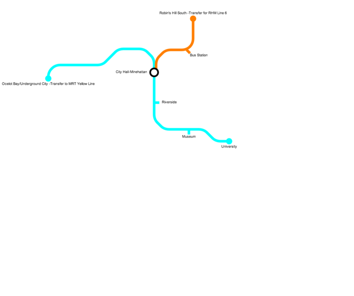
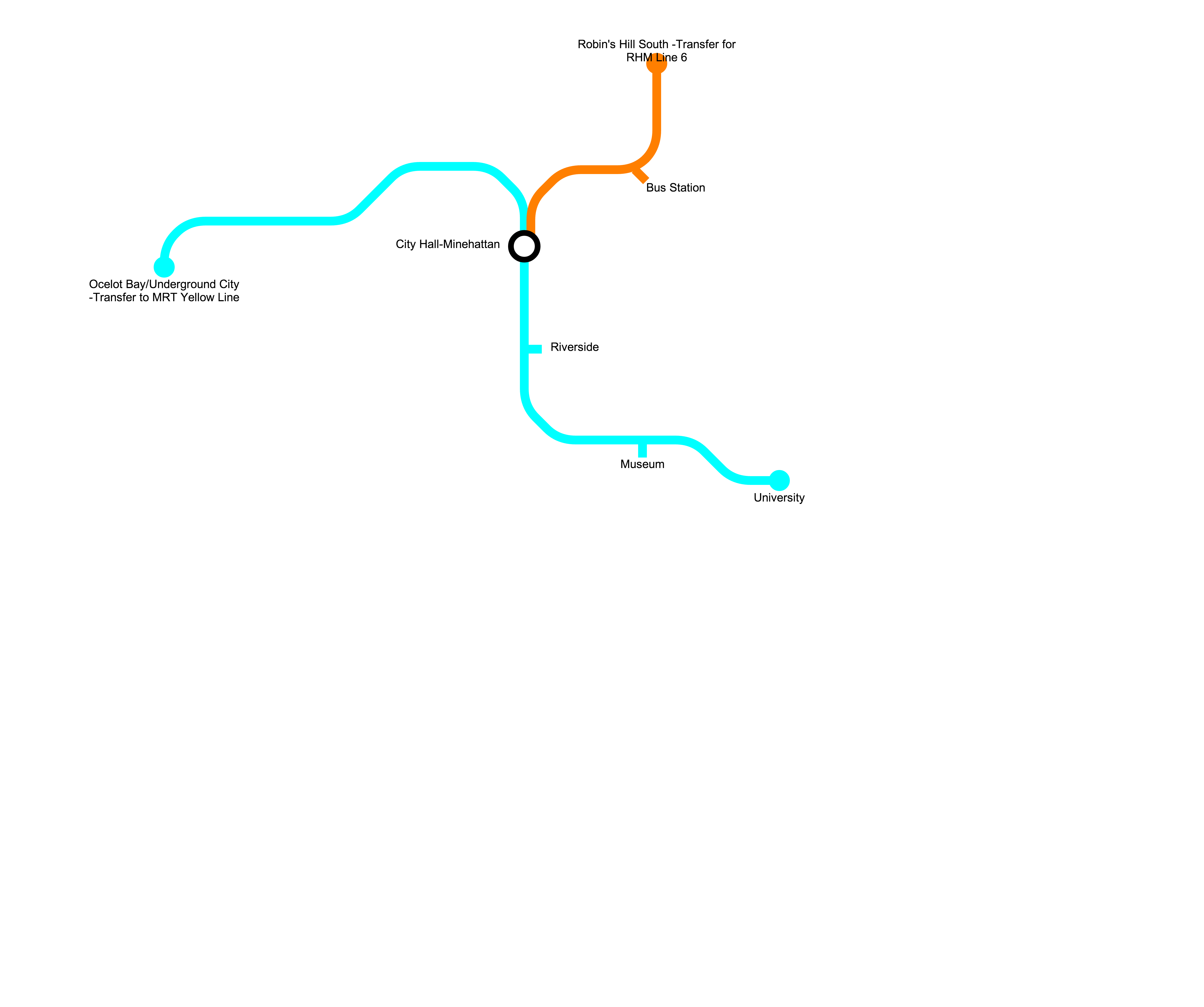
Map of the E-Z-Transit System (MRT Yellow Line included, only nearby stations)
File history
Click on a date/time to view the file as it appeared at that time.
| Date/Time | Thumbnail | Dimensions | User | Comment | |
|---|---|---|---|---|---|
| current | 22:34, 23 July 2014 | | 1,100 × 920 (40 KB) | Enjineer30302 (talk | contribs) | E-Z-Transit Map |
| 22:31, 23 July 2014 |  | 1,100 × 920 (40 KB) | Enjineer30302 (talk | contribs) | ||
| 22:22, 23 July 2014 | Error creating thumbnail: File with dimensions greater than 12.5 MP | 5,500 × 4,600 (572 KB) | Enjineer30302 (talk | contribs) | ||
| 22:17, 23 July 2014 | Error creating thumbnail: File with dimensions greater than 12.5 MP | 5,500 × 4,600 (572 KB) | Enjineer30302 (talk | contribs) | ||
| 22:16, 23 July 2014 | Error creating thumbnail: File with dimensions greater than 12.5 MP | 5,500 × 4,600 (572 KB) | Enjineer30302 (talk | contribs) | ||
| 22:18, 13 July 2014 | 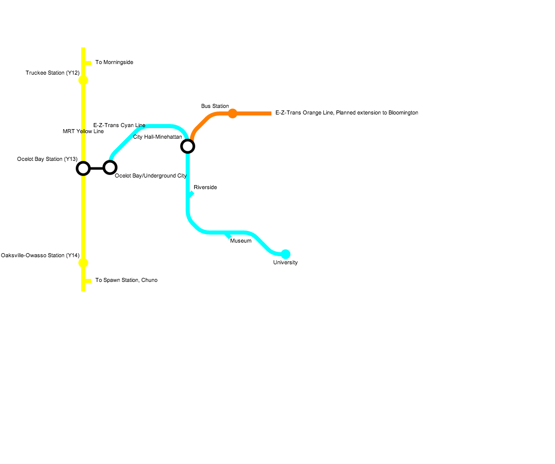 | 1,100 × 920 (52 KB) | Enjineer30302 (talk | contribs) | Map of the E-Z-Transit System (MRT Yellow Line included, only nearby stations) |
You cannot overwrite this file.
File usage
The following page uses this file: