File:Flrnanseiguntomap.png
Jump to navigation
Jump to search

Size of this preview: 554 × 600 pixels. Other resolution: 2,048 × 2,217 pixels.
Original file (2,048 × 2,217 pixels, file size: 551 KB, MIME type: image/png)
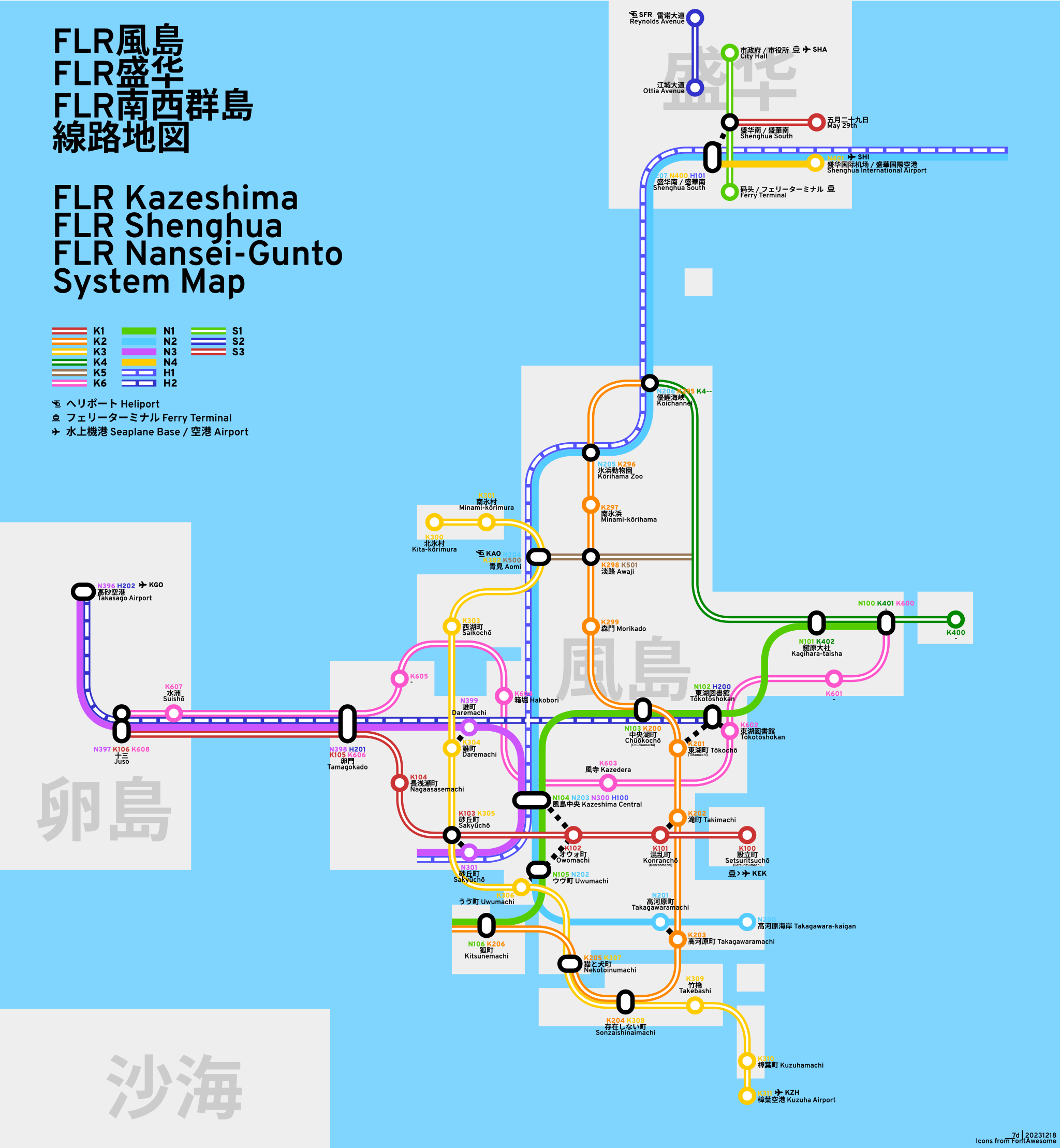
A map of FLR Nansei-Gunto (and FLR Kazeshima)
File history
Click on a date/time to view the file as it appeared at that time.
| Date/Time | Thumbnail | Dimensions | User | Comment | |
|---|---|---|---|---|---|
| current | 12:51, 18 December 2023 | | 2,048 × 2,217 (551 KB) | I 7d (talk | contribs) | |
| 12:39, 18 December 2023 |  | 2,048 × 2,217 (551 KB) | I 7d (talk | contribs) | ||
| 04:24, 22 May 2020 |  | 3,440 × 3,625 (587 KB) | I 7d (talk | contribs) | ||
| 04:21, 22 May 2020 | Error creating thumbnail: File with dimensions greater than 12.5 MP | 8,192 × 8,633 (1.58 MB) | I 7d (talk | contribs) | ||
| 04:18, 22 May 2020 | Error creating thumbnail: File with dimensions greater than 12.5 MP | 10,424 × 10,985 (2.09 MB) | I 7d (talk | contribs) |
You cannot overwrite this file.
File usage
The following 2 pages use this file: