File:Geneva Bay map.png
Jump to navigation
Jump to search

Size of this preview: 693 × 600 pixels. Other resolution: 722 × 625 pixels.
Original file (722 × 625 pixels, file size: 350 KB, MIME type: image/png)
Summary
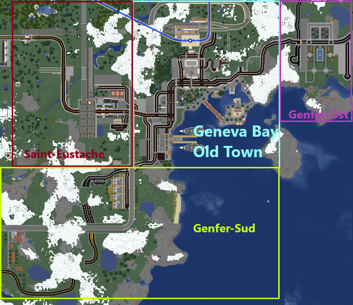
Map of Geneva Bay on 27 March 2020
File history
Click on a date/time to view the file as it appeared at that time.
| Date/Time | Thumbnail | Dimensions | User | Comment | |
|---|---|---|---|---|---|
| current | 15:09, 27 March 2020 | | 722 × 625 (350 KB) | Allifarki (talk | contribs) | Map of Geneva Bay on 27 March 2020 |
You cannot overwrite this file.
File usage
The following page uses this file: