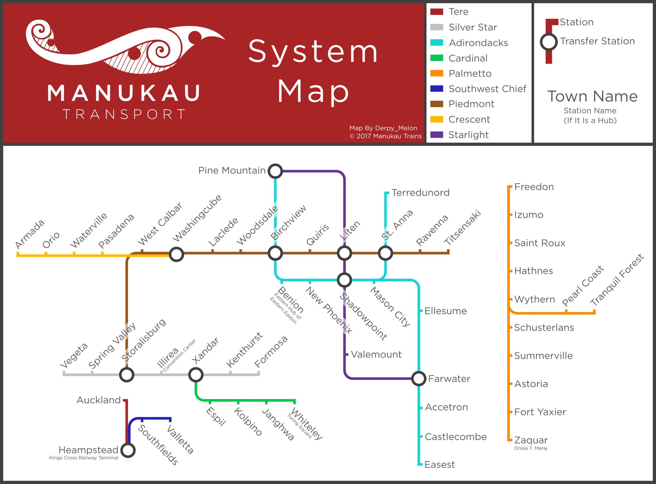
File:Manukau Map.png
Jump to navigation
Jump to search
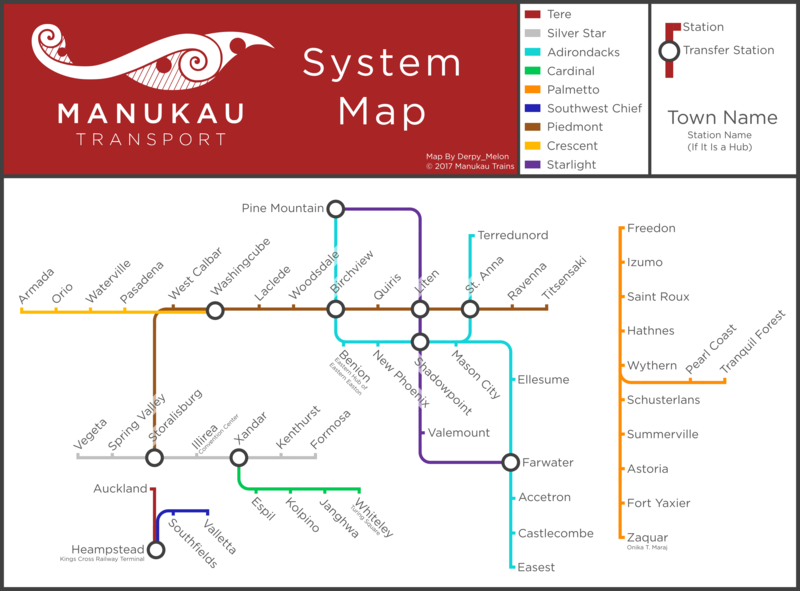
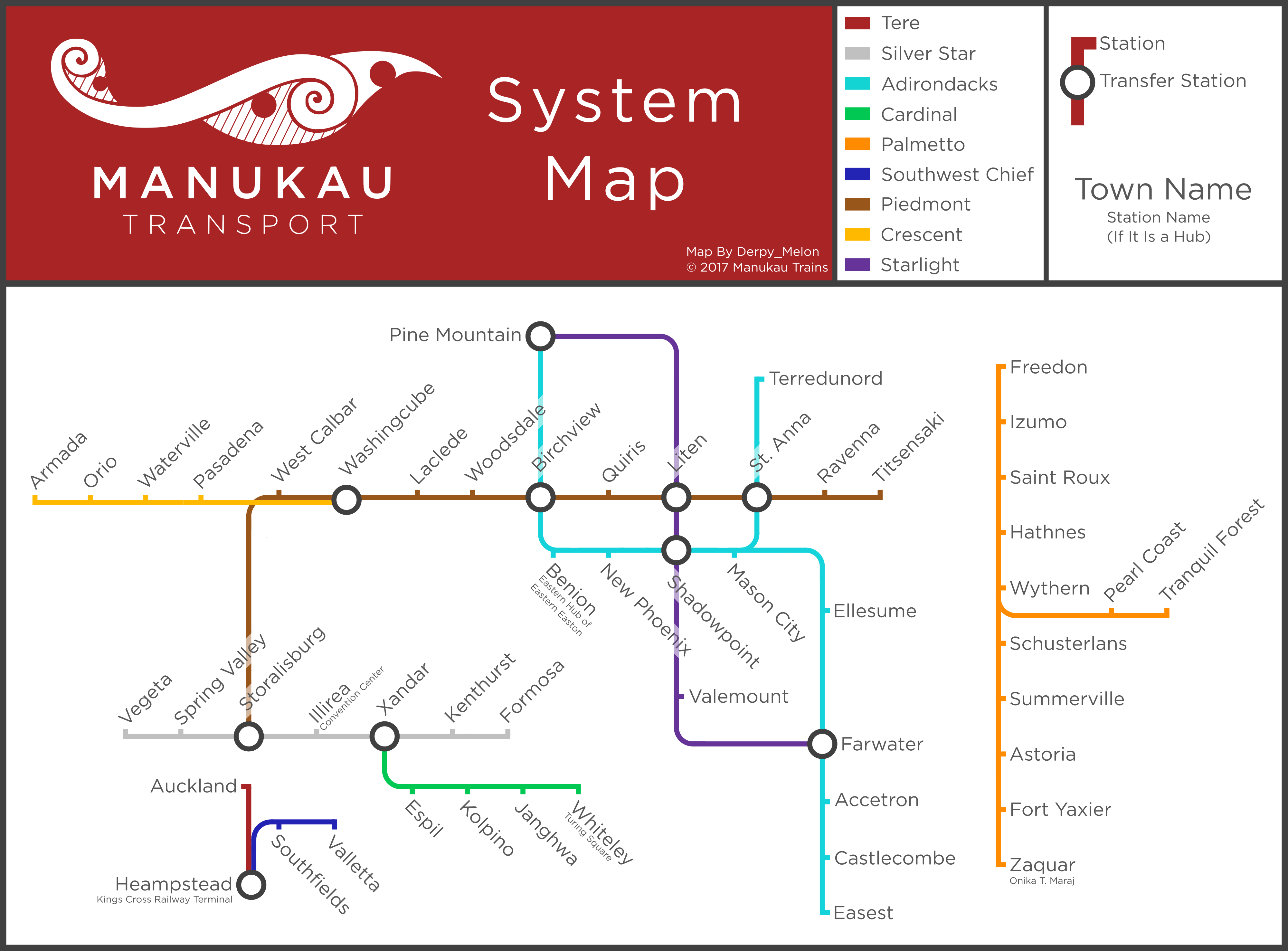
Size of this preview: 800 × 591 pixels. Other resolutions: 2,560 × 1,890 pixels | 4,000 × 2,953 pixels.
Original file (4,000 × 2,953 pixels, file size: 885 KB, MIME type: image/png)
File history
Click on a date/time to view the file as it appeared at that time.
| Date/Time | Thumbnail | Dimensions | User | Comment | |
|---|---|---|---|---|---|
| current | 23:16, 5 February 2017 | | 4,000 × 2,953 (885 KB) | Derpy Melon (talk | contribs) | Sooo.... Confusing.... |
| 17:23, 31 January 2017 | 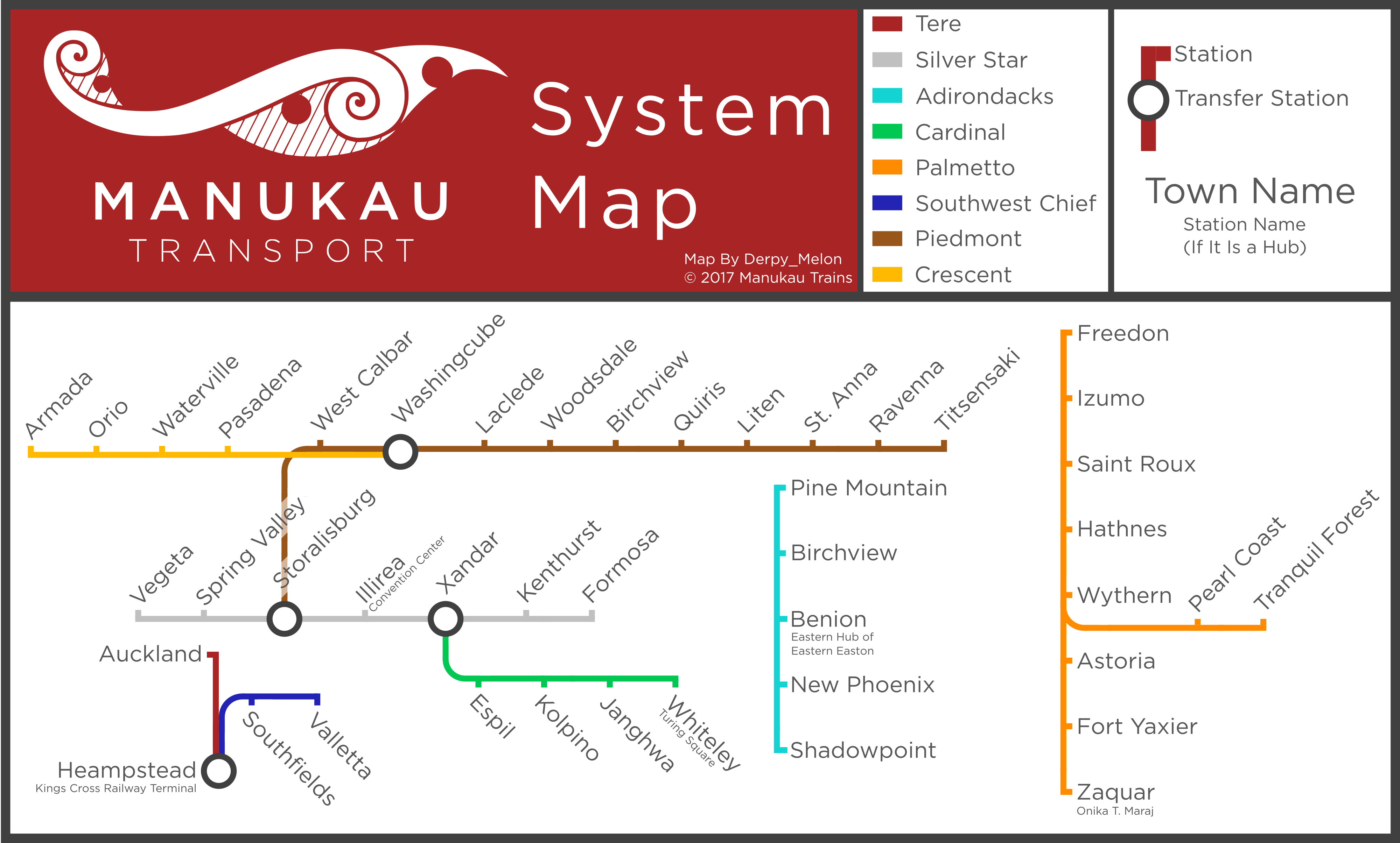 | 4,000 × 2,410 (805 KB) | Derpy Melon (talk | contribs) | Updated!!! | |
| 20:41, 11 January 2017 |  | 3,236 × 2,501 (628 KB) | Derpy Melon (talk | contribs) | ||
| 20:29, 26 December 2016 |  | 3,138 × 2,195 (546 KB) | Derpy Melon (talk | contribs) | removed extra space around the map... | |
| 20:27, 26 December 2016 |  | 3,499 × 2,408 (556 KB) | Derpy Melon (talk | contribs) | plz dont be too big... | |
| 20:27, 26 December 2016 | Error creating thumbnail: File with dimensions greater than 12.5 MP | 5,248 × 3,612 (885 KB) | Derpy Melon (talk | contribs) | ||
| 20:25, 26 December 2016 | Error creating thumbnail: File with dimensions greater than 12.5 MP | 8,747 × 6,020 (1.72 MB) | Derpy Melon (talk | contribs) |
You cannot overwrite this file.
File usage
The following page uses this file: