File:STCMetroMap.png
Jump to navigation
Jump to search

Size of this preview: 543 × 599 pixels. Other resolution: 2,000 × 2,207 pixels.
Original file (2,000 × 2,207 pixels, file size: 507 KB, MIME type: image/png)
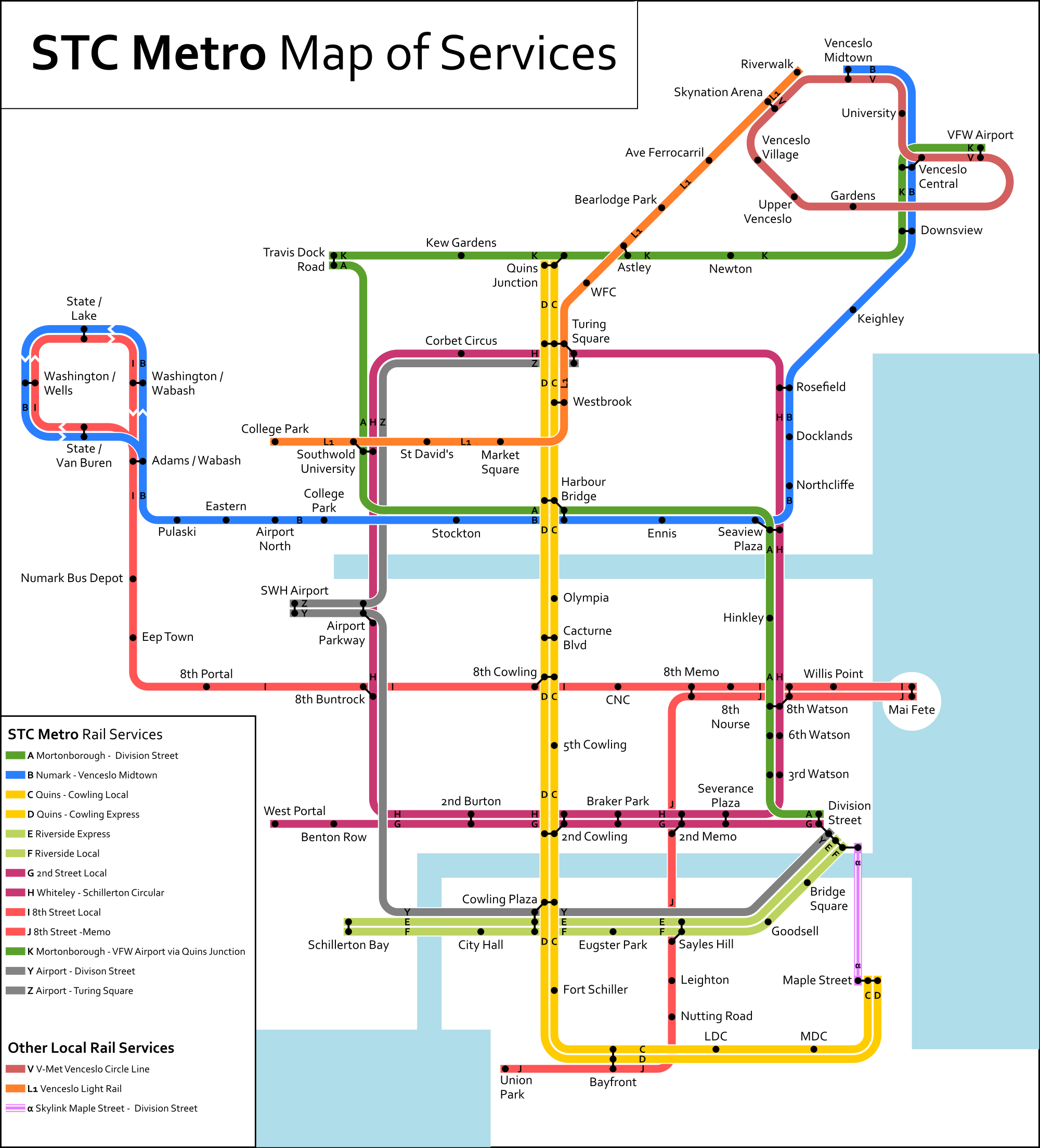
Map of the full future STC metro
File history
Click on a date/time to view the file as it appeared at that time.
| Date/Time | Thumbnail | Dimensions | User | Comment | |
|---|---|---|---|---|---|
| current | 09:30, 11 April 2020 | | 2,000 × 2,207 (507 KB) | AP Red (talk | contribs) | |
| 16:06, 29 August 2019 |  | 2,000 × 2,207 (483 KB) | AP Red (talk | contribs) | ||
| 19:03, 27 December 2017 | 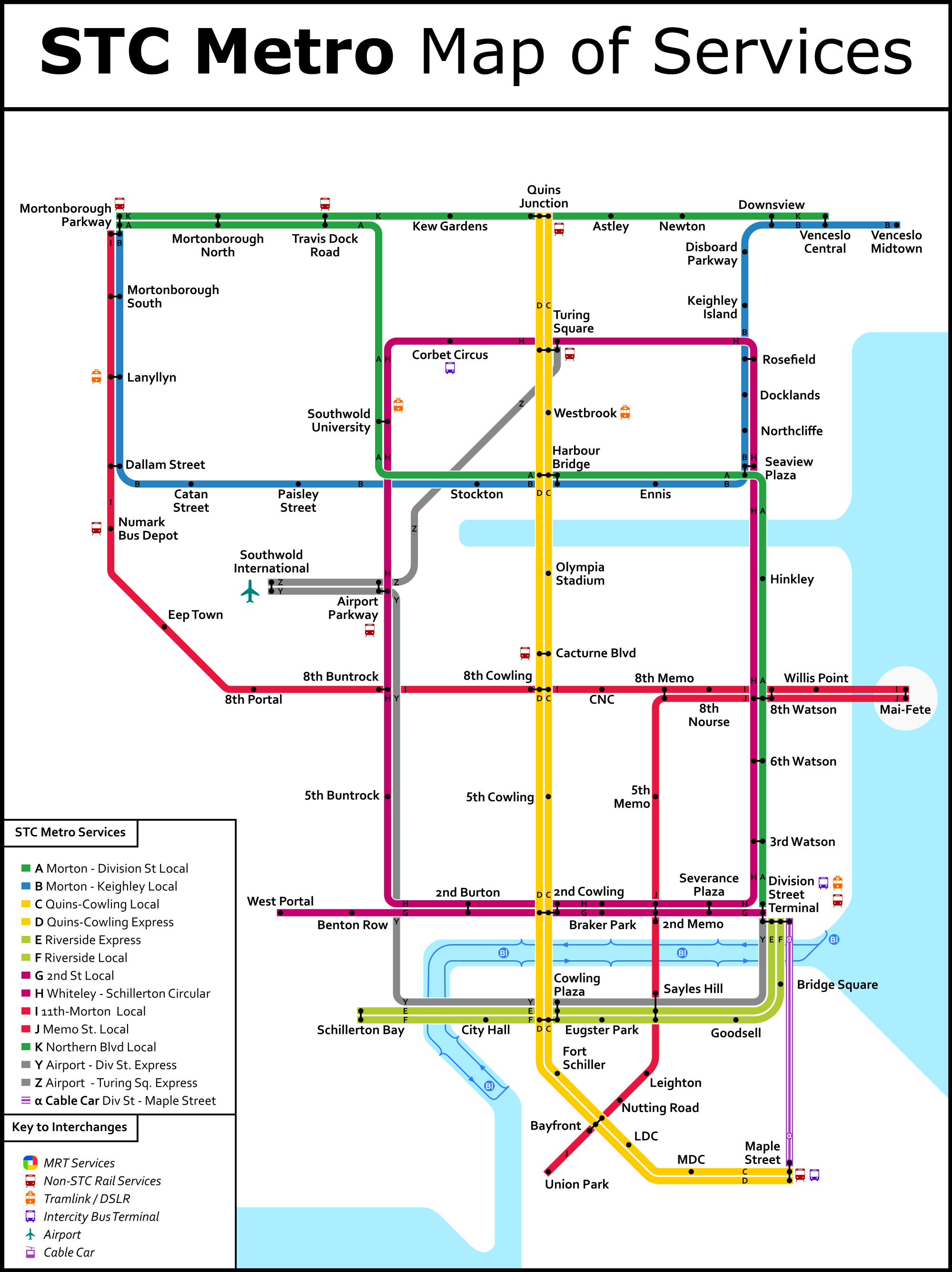 | 2,000 × 2,672 (558 KB) | AP Red (talk | contribs) | ||
| 19:26, 10 December 2017 | 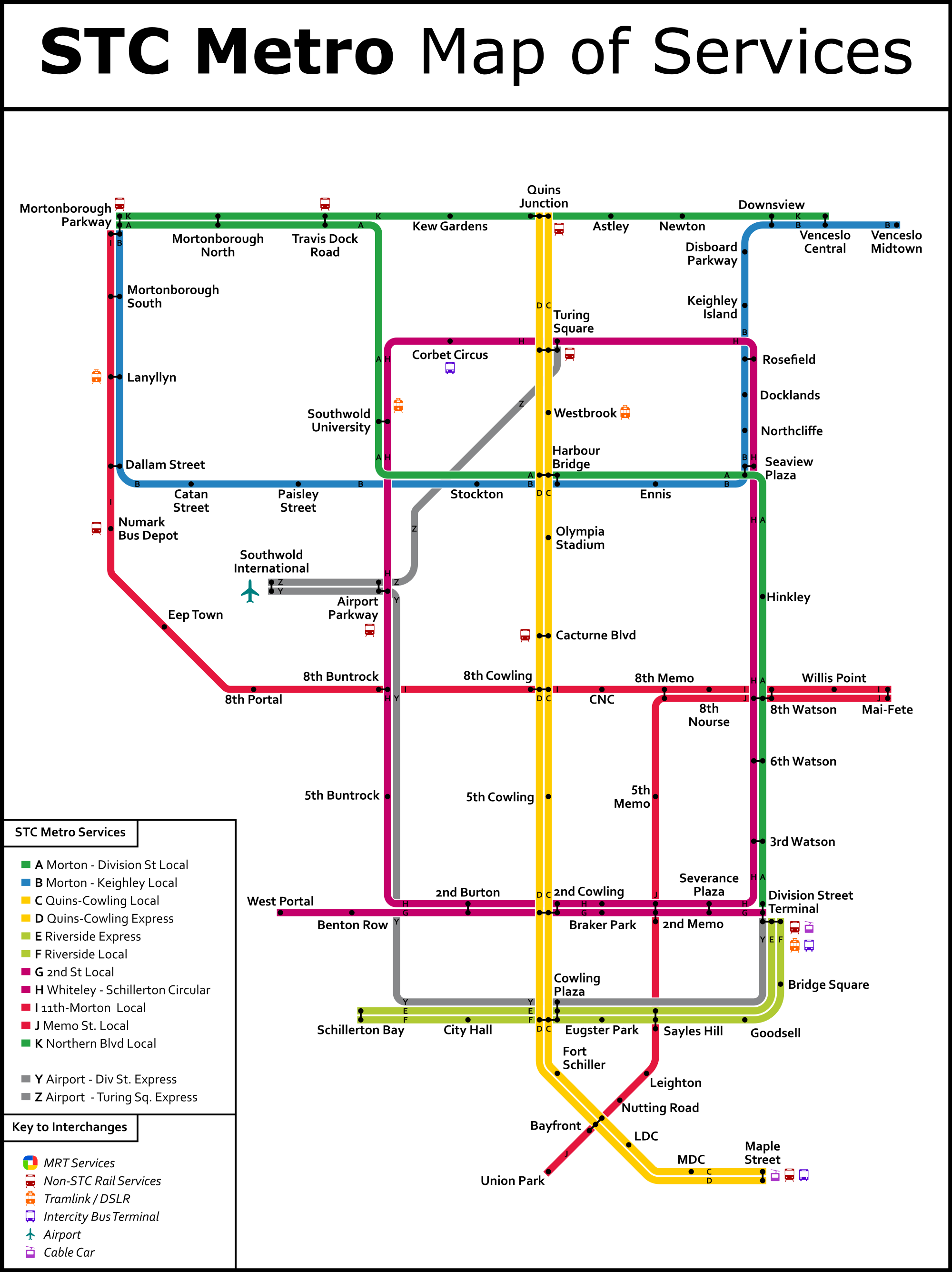 | 2,000 × 2,672 (524 KB) | AP Red (talk | contribs) | ||
| 19:25, 10 December 2017 |  | 2,000 × 2,672 (524 KB) | AP Red (talk | contribs) | ||
| 20:56, 2 September 2017 | 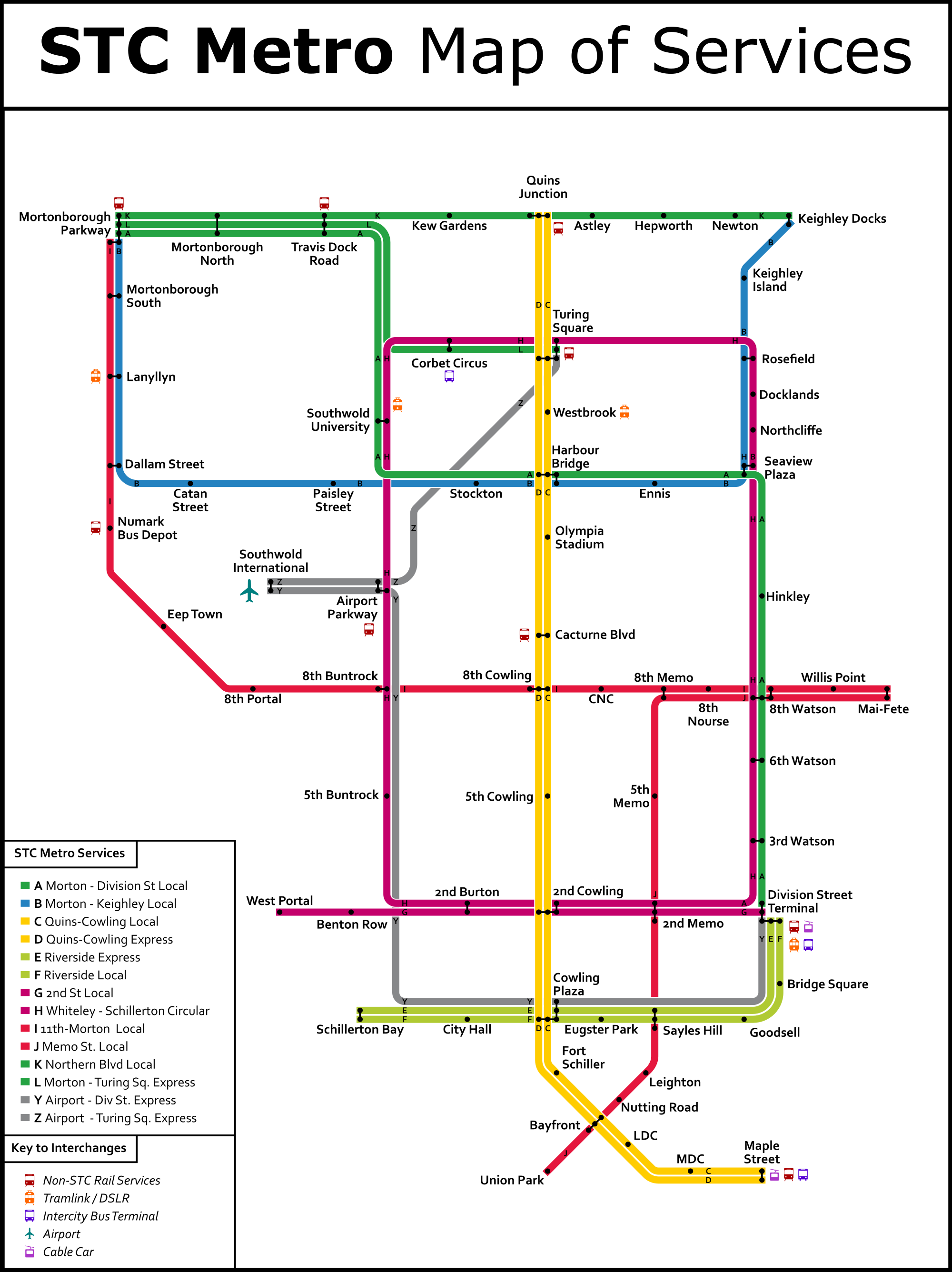 | 2,000 × 2,672 (506 KB) | AP Red (talk | contribs) | ||
| 08:45, 8 July 2016 | 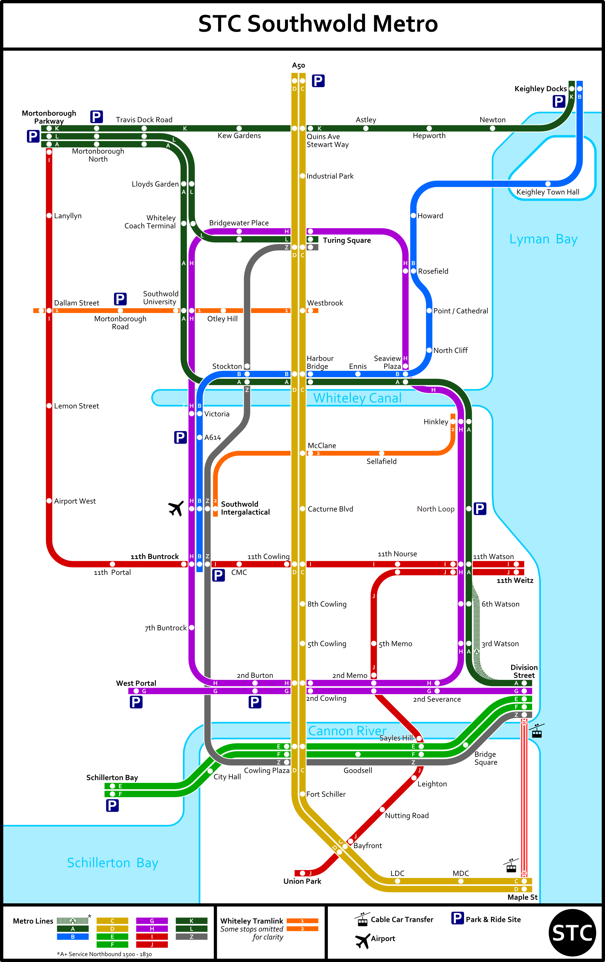 | 2,000 × 3,178 (563 KB) | AP Red (talk | contribs) | ||
| 19:55, 2 June 2016 | 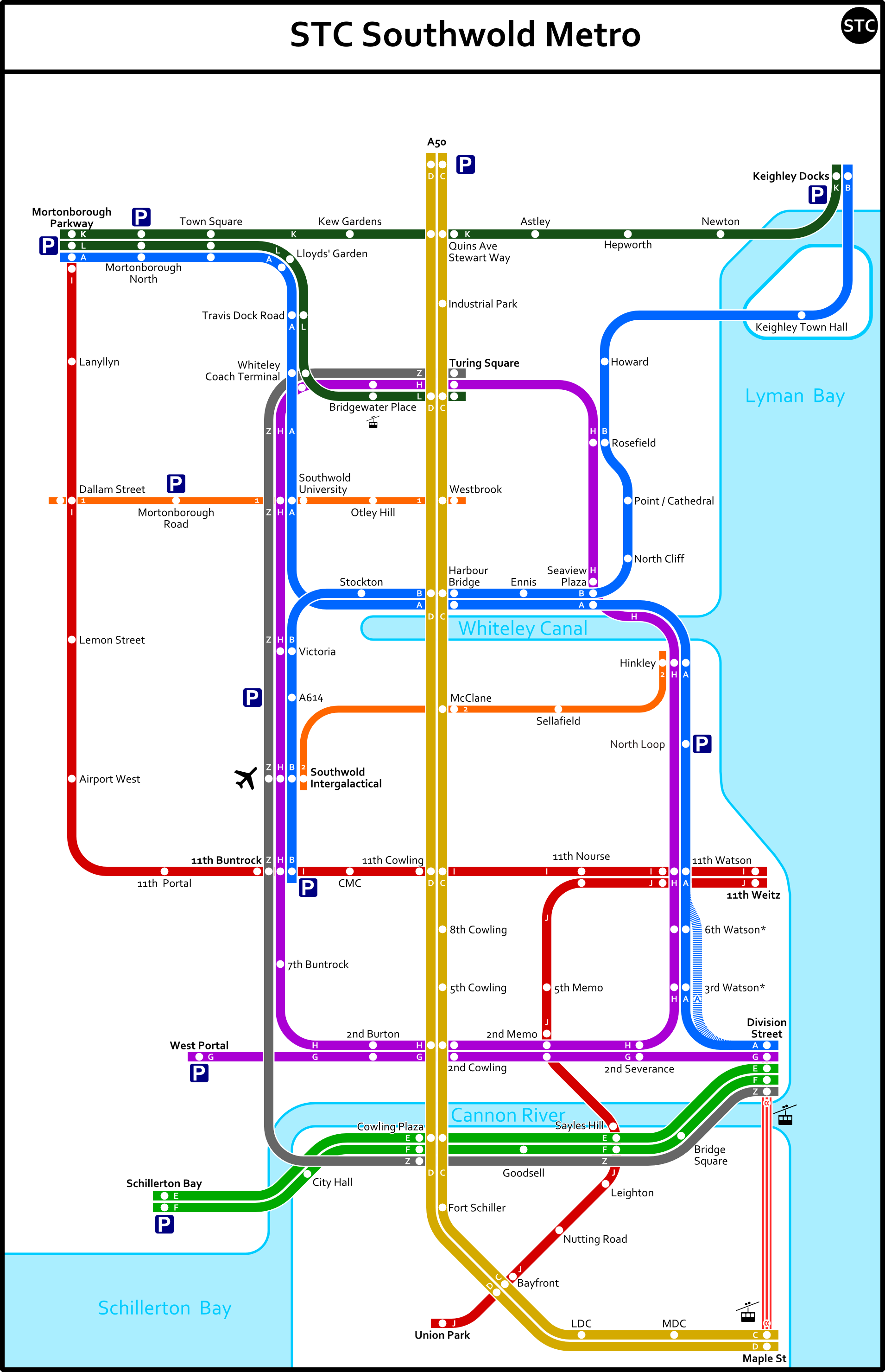 | 1,910 × 2,960 (461 KB) | AP Red (talk | contribs) | ||
| 09:09, 21 May 2016 |  | 1,910 × 2,960 (453 KB) | AP Red (talk | contribs) | ||
| 15:49, 2 May 2016 | 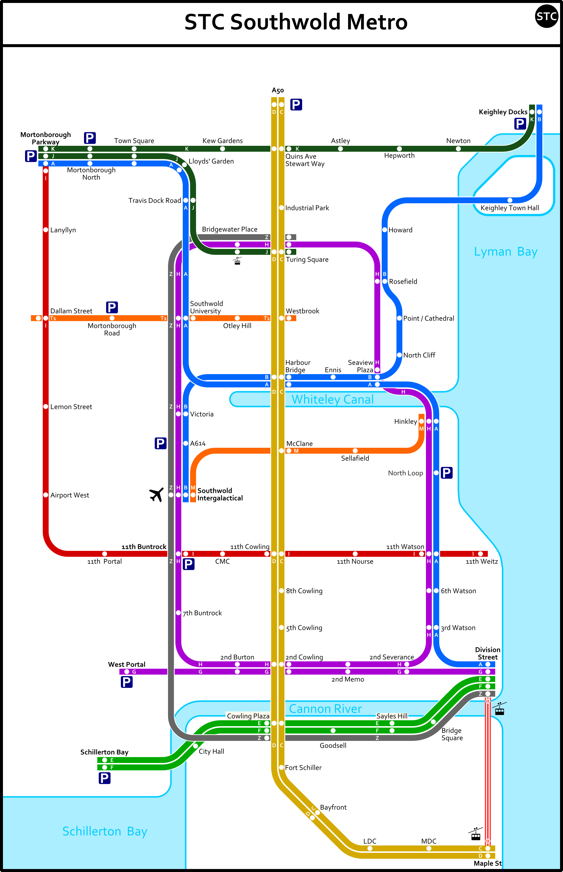 | 1,910 × 2,960 (421 KB) | AP Red (talk | contribs) | Map of the full future STC metro |
You cannot overwrite this file.
File usage
The following 2 pages use this file: