File:Tenative Fairfax Road Map.jpg
Jump to navigation
Jump to search

Size of this preview: 800 × 479 pixels. Other resolution: 1,468 × 879 pixels.
Original file (1,468 × 879 pixels, file size: 480 KB, MIME type: image/jpeg)
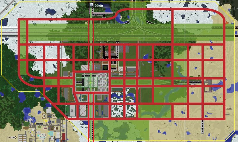
Planned Roads of Fairfax. Dependent on adjacent mayors' approvals.
RED - Roads YELLOW - City Boundary as of 12/29/2013 GREEN - Natural Park/Landscaped Areas
File history
Click on a date/time to view the file as it appeared at that time.
| Date/Time | Thumbnail | Dimensions | User | Comment | |
|---|---|---|---|---|---|
| current | 10:22, 29 December 2013 | | 1,468 × 879 (480 KB) | Frozen (talk | contribs) | Planned Roads of Fairfax. Dependent on adjacent mayors' approvals. RED - Roads YELLOW - City Boundary as of 12/29/2013 GREEN - Natural Park/Landscaped Areas |
You cannot overwrite this file.
File usage
The following page uses this file: