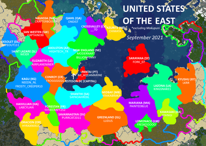
File:USEmap.png
Jump to navigation
Jump to search


Size of this preview: 800 × 566 pixels. Other resolution: 999 × 707 pixels.
Original file (999 × 707 pixels, file size: 762 KB, MIME type: image/png)
Map of the United States of the East
File history
Click on a date/time to view the file as it appeared at that time.
| Date/Time | Thumbnail | Dimensions | User | Comment | |
|---|---|---|---|---|---|
| current | 11:13, 19 September 2021 | | 999 × 707 (762 KB) | Airplaneguy9 (talk | contribs) | Updated state map (19 Sep 2021) |
| 15:08, 23 August 2021 | 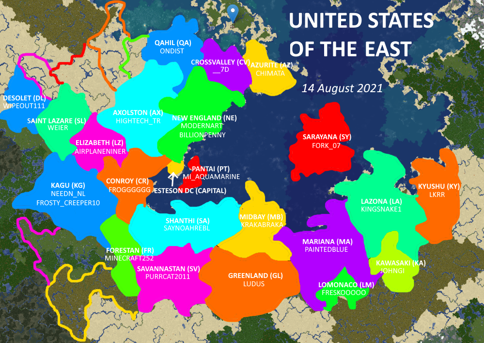 | 999 × 707 (827 KB) | Airplaneguy9 (talk | contribs) | more | |
| 15:57, 15 August 2021 | 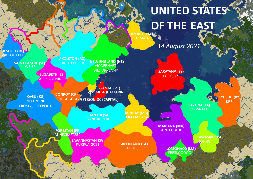 | 999 × 707 (851 KB) | Airplaneguy9 (talk | contribs) | added Forestan | |
| 10:22, 15 August 2021 | 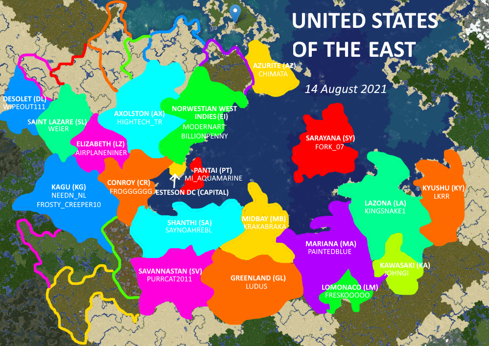 | 999 × 707 (864 KB) | Airplaneguy9 (talk | contribs) | moar states | |
| 14:17, 13 August 2021 | 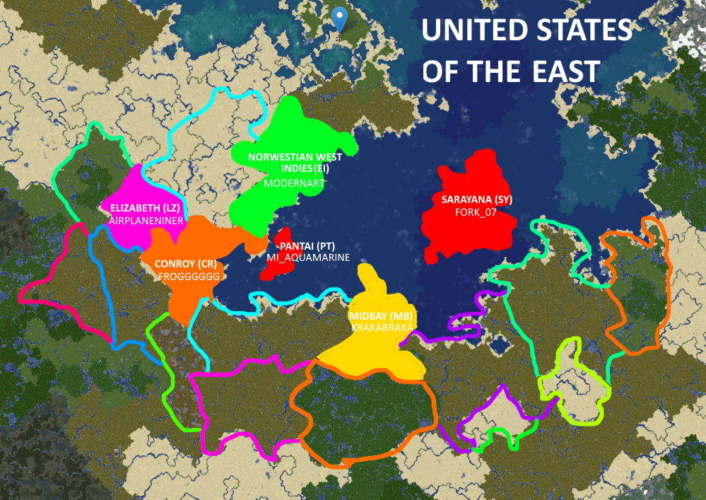 | 999 × 707 (1.12 MB) | Airplaneguy9 (talk | contribs) | Added more states | |
| 13:38, 13 August 2021 | 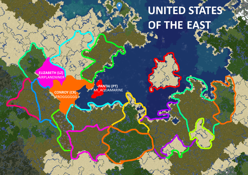 | 999 × 707 (1.17 MB) | Airplaneguy9 (talk | contribs) | changed position of Conroy and added Pantai | |
| 13:35, 13 August 2021 | 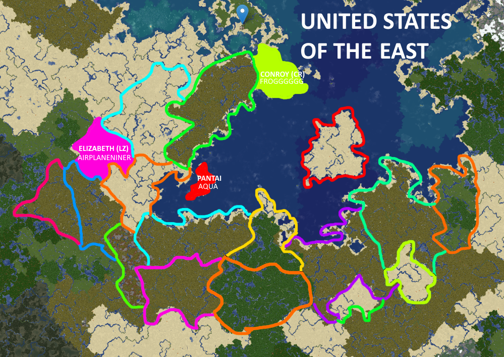 | 999 × 707 (1.18 MB) | Airplaneguy9 (talk | contribs) | ||
| 13:21, 13 August 2021 |  | 999 × 707 (1.18 MB) | Airplaneguy9 (talk | contribs) |
You cannot overwrite this file.
File usage
The following 2 pages use this file: