Map World
The Map World is the seventh world to be created on the MRT, and the first to be created since the Gamma server launch on October 4, 2014. This world was created during the server's 1.13 update. The Map World was generated with a grid that aligns with the 128x128 regions that Minecraft maps align with. The central nine grid squares are protected, and consist of eight solid colors and the world spawn. At spawn, there is the Map Library, currently managed by AP_Red. This library takes any user-submitted maps and puts them on display in the library under spawn. Megascatterbomb constructed the spawn area of the world.
Members may claim any map square that has not already been used, and build on it immediately. Once their map is finished, they can generate a Minecraft map and use it wherever they please. Currently, there are 952 usable squares on the Map World. Since there is a limited amount of space, it is still recommended to upload maps directly to the server when possible, as there is a practically unlimited amount of Map ID's, but only so much space on the world.
Library
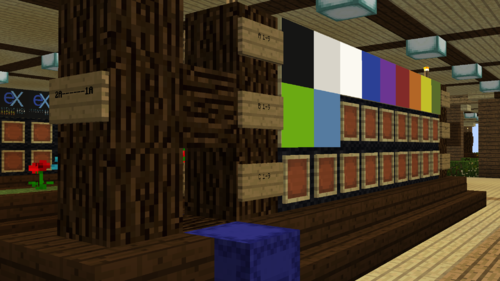
The Map World spawn consists of a small spawn area in the middle, surrounded by four buildings that lead to the underground Map Library. The library's primary purpose is the display and documentation of maps that have been uploaded to or built on the server. This library is managed by AP_Red, who is in charge of arranging and documenting the maps in the library. Members can submit maps for display by using the deposit box just in front of the spawn point.
The index of all the maps currently on display is available here. The numbering used in the spreadsheet matches the numbering in the library itself.
Submitting maps for display
Members may submit maps for display by following these instructions:
- First, create a shulker box renamed to your username. Only this shulker box will be placed in the deposit box. This is required in the event there are any queries about your submission.
- Then, name each of the maps you wish to submit with a short description of what the map is an image of. This will assist greatly in the documentation of these maps.
- Finally, place all your maps in the shulker box, and place the shulker box in the deposit box.
Library indexing system
The library uses a simple indexing system. Each tab on the spreadsheet represents one of the colored sections around the library. Therefore the first part of the index is the colour (Blue, Green, Yellow, Red). The second part of the index is the Aisle. Aisle's 1-6 are on the first floor, while 7-12 are on the second floor. The letter in the Aisle indicates how far from the front of the building (where the staircase is) the display is, with A being closest to the front, B in the middle, and C right at the back. The above info is enough to locate a specific wall inside the library. Each wall is a square on the larger grid in the spreadsheet, with a smaller grid inside that mimics the wall's physical layout.
Each wall also has a co-ordinate system that can specify an exact map. This is useful if you want to specify an exact map in text description only. Rows are specified by the letters A, B or C in descending order. The columns are numbered 1-9, left to right. Unlike indexes for an Aisle, the letter is put first, then the number.

