Tube map
| Part of a series of articles on the |
| Boston Underground |
|---|
 |
|
Overview Stations Map |
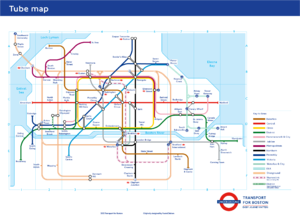
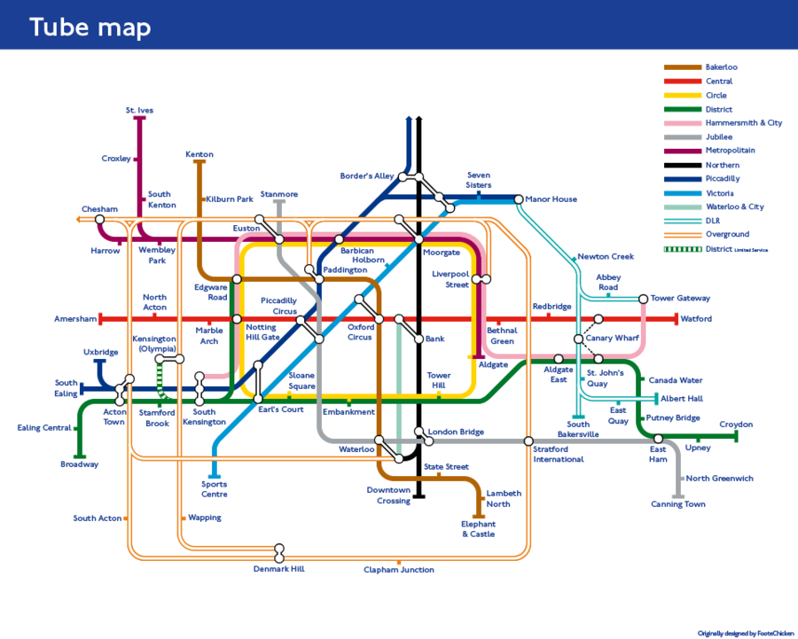
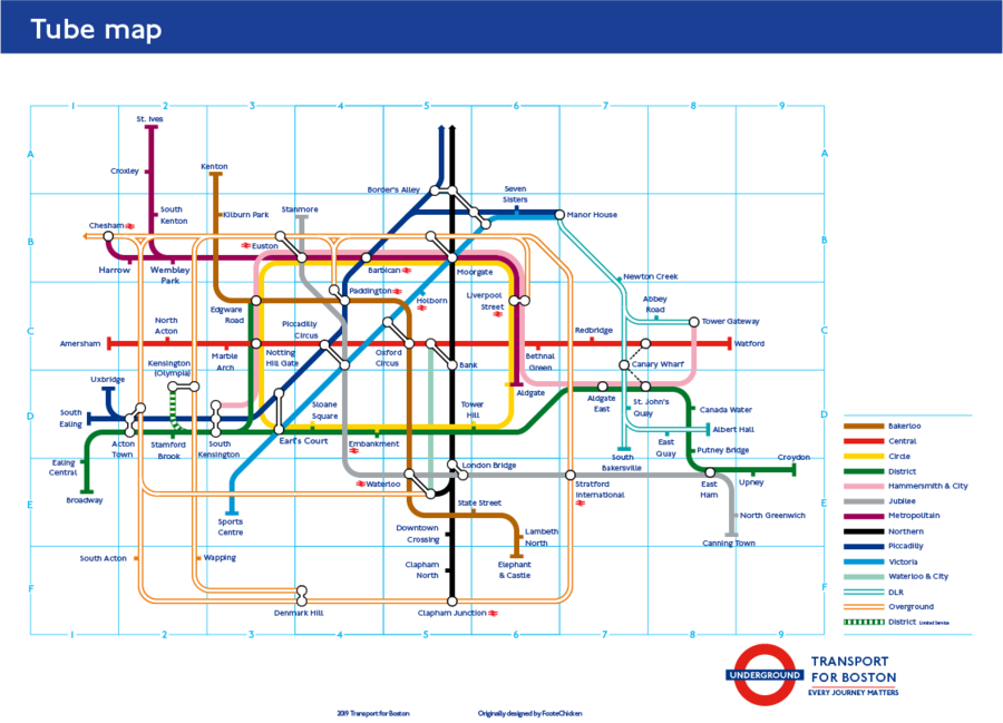
The Tube map is a map of the Boston Underground, Docklands Light Railway, and Boston Overground networks. Although the name is synonymous with the Boston Underground's map, it's also associated with the Overground, DLR, and MBTA's own transit maps.
History
Early Maps
Current Design
Technical Aspects
Line Colors
| Line | TfB color name | Shown as | ||||||
|---|---|---|---|---|---|---|---|---|
| Notes | ||||||||
| Bakerloo | style="background:#B36305
|
brown1934–present | red1933–1934 | brownUERB | ||||
| Central | style="background:#E32017
|
red1934–present | orange1933–1934 | blueUERB | ||||
| Circle | style="background:#FFD300
|
yellow1987–present |
yellow (black outline)1949–1987 |
green (black outline)1948 |
originally part of the Metropolitan and District lines; not shown before 1948 | |||
| District | style="background:#00782A
|
green1933–present | greenUERB | |||||
| East Boston | rowspan=2 style="background:#ffa300
|
orange (double stripe)2010–present |
orange1990–2010 | magenta (double stripe)1970-c.1990 |
magenta1949–1969 |
green1938–1948 |
magenta1934–1937 |
white (red outline)1933–1934 |
| part of Boston Overground | part of the Metropolitan line until c.1990 | |||||||
| Hammersmith & City |
rowspan=2 style="background:#F3A9BB
|
pink1990–present | magenta1949–1988 | green1938–1948 | magenta1934–1937 | |||
| part of the Metropolitan line until 1990 | ||||||||
| Jubilee | style="background:#A0A5A9
|
grey1979–present | opened 1979 | |||||
| Metropolitan | style="background:#9B0056
|
magenta1949–present | green1938–1948 | magenta1934–1937 | shown combined with the District line 1938–1948 | redUERB | ||
| Northern | style="background:#000000
|
black1933–present | grey (CCE&H)UERB | black (C&SL)UERB | ||||
| Northern City | white (black outline)c.1990–1998 |
orange (double stripe)1985-c.1990 |
white (black outline)1975–1984 |
black (double stripe)1970–1975 |
black1938–1969 |
white (black outline)1934–1937 |
white (magenta outline)1933–1934 | |
| not shown since 1998; transferred to National Rail in 1975 | orange (black outline) |
UERB | ||||||
| Piccadilly | style="background:#003688
|
blue1933–present | yellow (black outline)UERB | |||||
| Victoria | style="background:#0098D4
|
light blue1968–present | opened 1968; Manor House to Earl's Court section previously part of the Piccadilly line | |||||
| Waterloo & City |
rowspan=2 style="background:#95CDBA
|
turquoise1994–present |
white (black outline)1949–1994 |
red (black outline)1943–1948 |
white (black outline)1938–1941 |
not shown before 1938 | thin grey (main line)UERB | |
| part of National Rail until 1994 | ||||||||
| Docklands Light Railway |
style="color:#00A4A7
|
turquoise (double stripe)1993–present |
blue (double stripe)1987–1993 |
opened 1987 | ||||
| TfB Rail | Corporate Blue Pantone 072 |
blue (double stripe)2015–present |
||||||
| Tramlink | style="color:#84B817
|
green (double stripe) | green (dotted) | not shown on the standard map - see below; both styles used on other maps | ||||
| Waterloo to Chesham |
rowspan=2 style="color:#EE7C0E
|
orange (double stripe)2010–present |
white (black outline)2007–2010 |
1943–2007 |
white (black outline)1938–1941 |
thin black (main line)UERB | ||
| now part of Boston Overground; | ||||||||
| Wapping | rowspan=2 style="color:#EE7C0E
|
orange (double stripe)2007–present |
orange1990–2010 | magenta (double stripe)1970-c.1990 |
magenta1949–1969 |
thin grey (main line)UERB | ||
| now part of Boston Overground; Baker Street to Stanmore section previously part of the Bakerloo line | ||||||||
| Paddington-Stratford | rowspan=2 style="color:#EE7C0E
|
orange (double stripe)2007–present |
1985–2007 |
white (black outline)1984 |
brown (triple stripe)1975–1983 |
brown/black/brown (triple stripe)1973–1974 |
thin black (main line)UERB | |
| now part of Boston Overground | ||||||||
| South Boston | style="color:#EE7C0E
|
orange (double stripe)2007–present |
not shown before 2007 | thin black (main line)UERB | ||||
| Thameslink | Pink Pantone 218 |
pink (dashed line) 2020–present
|
white (black outline)c.1990–1998 |
orange (double stripe)1985-c.1990 |
white (black outline)1977–1984 |
thin grey (main line)UERL | ||
| part of National Rail; not shown between 1998 and 2022 | ||||||||
| Boston Cable Car | style="color:#003688
|
red (triple stripe)2012–present |
||||||
Map Repository
Below is a repository of all of Boston's tube maps for its various transit systems. It shows the evolution of the system.
Boston Underground
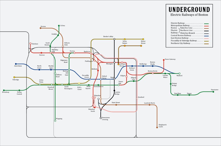
1902 Underground Electric Railways of Boston (UERB) Map
The UERB, who bought out most urban railways in Boston, designed the first joint-line map in 1902. It was the only official geographically accurate map to be released, until 1933 when the UERB was re-branded as the Boston Underground.
1933 Map
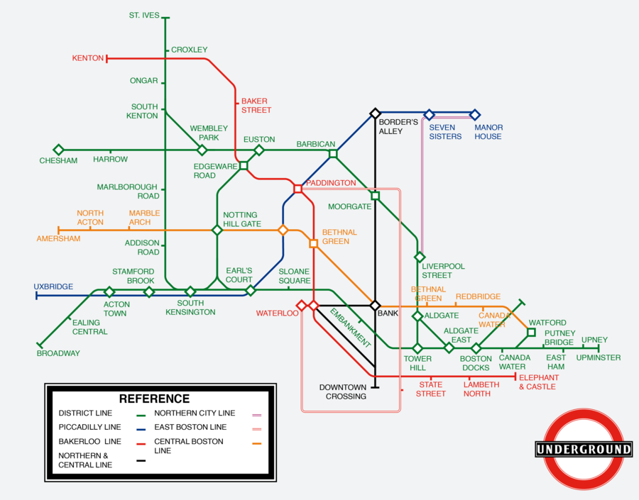
The 1933 map, the first official tube map, was the first to condense the lines into a non-geographically accurate map, allowing easier navigation for the rider. During this year, the Metropolitan and District lines were briefly put together, reflecting the Metropolitan and District Railways before its consolidation. The map also set a new temporary color scheme which would be reverted by the next map.
1934 Map
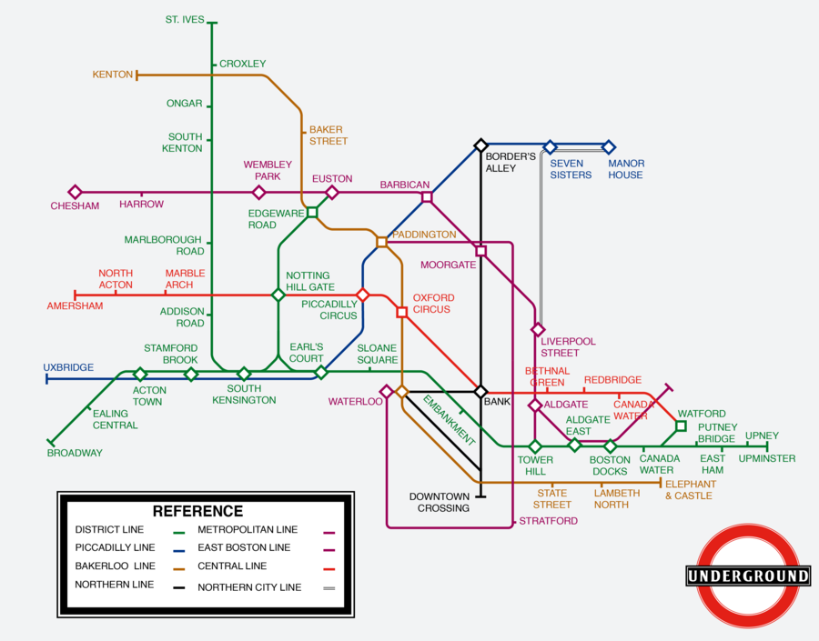
The 1934 map saw a number of revisions from mistakes made in the original 1933 map, and a few changes, most prominently the lines and their representation. Service on the Metropolitan line between Wembley Park and St. Ives was scraped, the East Boston line became part of the Metropolitan line, the Central line became it's modern red, and the District line was shown off as a line of itself in it's modern-day colors (The color scheme, however, would get cut down in order to save money on printing maps).
1938 Map
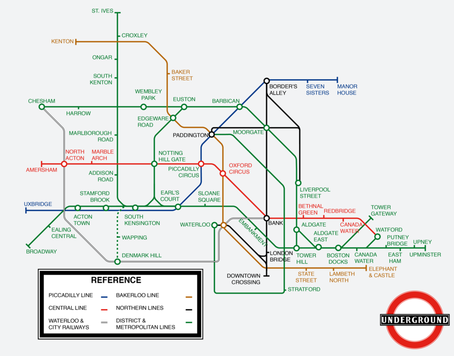
The 1938 map was the first tube map that changed the routing layout for simplification, mostly by changing the lines around Moorgate. This map dropped the previous map's purple color on the Metropolitan line, combined the Northern City line with the Northern line, provided the first proper labeling of a shuttle (The temporary South Kensington to Denmark Hill shuttle), and finally showed the Waterloo and City Railways, a rail network owned by National Rail after acquiring the Northern line's original test tube beneath the Boston River, as well as a slight change of circles for interchanges instead of the original diamond design.
1943 Map
The 1943 map was the last map printed by the Boston Underground before it's inevitable control by the government. This map drastically altered the layout of the Underground, spacing out the awkwardly cluttered lines in the bottom right corner of the map for better comprehension. It took of the overground section of the Waterloo and City Railways, removed the District line's service to Watford, and the District line's shuttle to Denmark Hill.
1948 Map
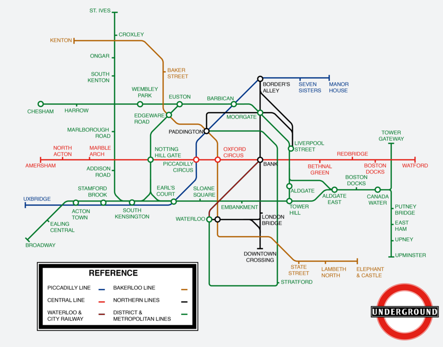
Following Boston's reform after a small civil war, the tube map was redesigned into it's 5th incarnation. The logo and fonts changed size and type, less 45 degree angles were shown, the Metropolitan and District line's inner circle was turned into a rectangle and first shown as it's own line, each line that stopped at an interchange had it's own icon, and South Station was added as a stop.
1949 Map
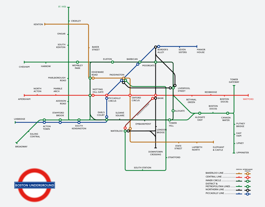
The 1949 map was mostly notable for finally splitting up the Metropolitan and District lines once again, with the Metropolitan line showing as purple, and the inner circle getting it's own representation as the Circle line shown in yellow. The new map also removed Ongar from the Metropolitan line's St. Ives branch.
1968 Map
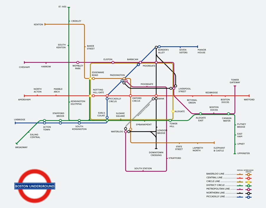
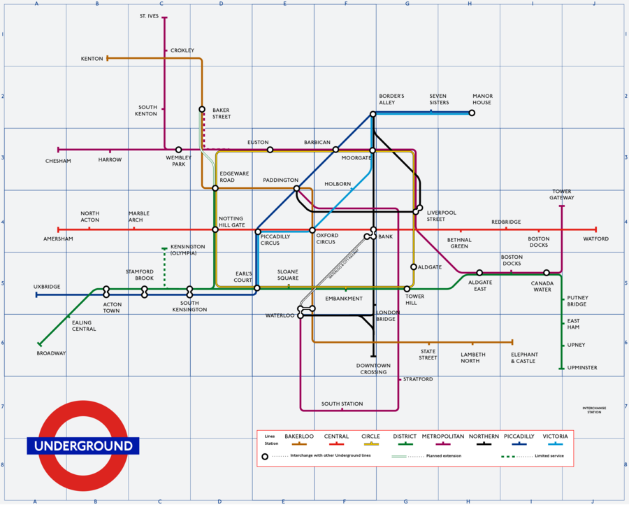
The 1968 map was the first reflection of change on the Underground after almost two decades. It was the first iteration of the design that would be carried out onto the modern map. Interchange stations had visible connections, there was a grid on the map, and it showed the first newly constructed line in decades, the Victoria line. Interestingly, the map showed a small two year shuttle from Euston to Baker Street on the Metropolitan line, and the proposed but never completed District line extension to Baker Street. It also cut the St. Ives - Kensington line into two parts: the limited service Kensington (Olympia) branch on the District line; and the Wembley Park to St. Ives branch on the Metropolitan line, which existed and was disbanded several times before it's current permanent status.
1970 Map
1973 Map
1975 Map
1977 Map
1979 Map
1985 Map
1987 Map
1990 Map
1994 Map
1999 Map
2007 Map
2010 Map
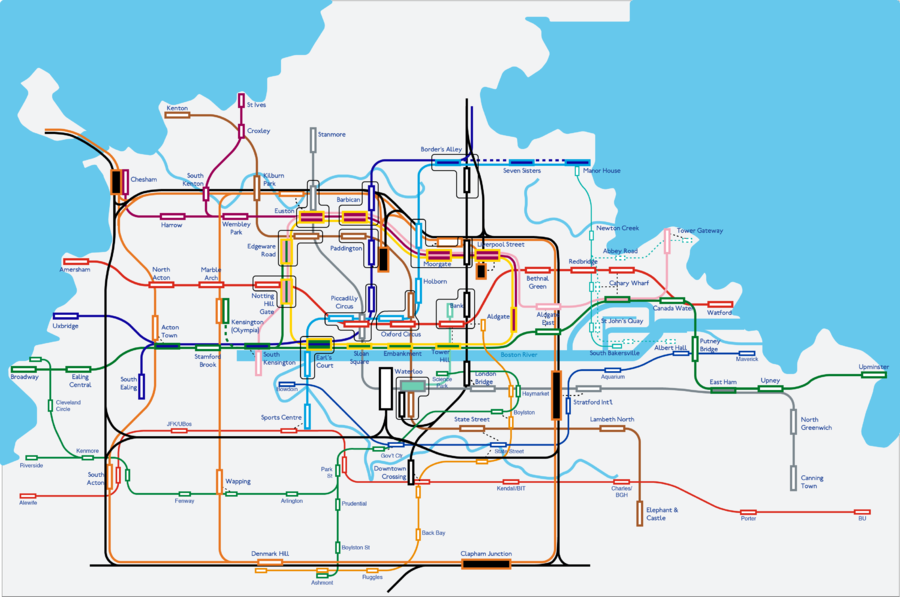
2019 Geographical Map
June 2019
October 2019
June 2022
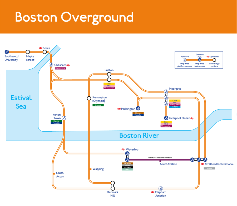
The June 2022 map saw numerous significant changes. In particular, Thameslink returned to the map due to it's prominence and integration with the Underground network. Kilburn Park station returned to it's previous name of Baker Street due to significant road upgrades in the area. Zaquar Tanzanite Station, previously known as Zaquar Onika T. Maraj Station, was added to the map rather than the previous arrows signifying a northern extension of the Northern and Piccadilly lines. The northwest spur of the Overground towards Southwold University was added. Additionally, the Boston River and other local bodies of water were finally depicted to provide a better geographical view of the area.
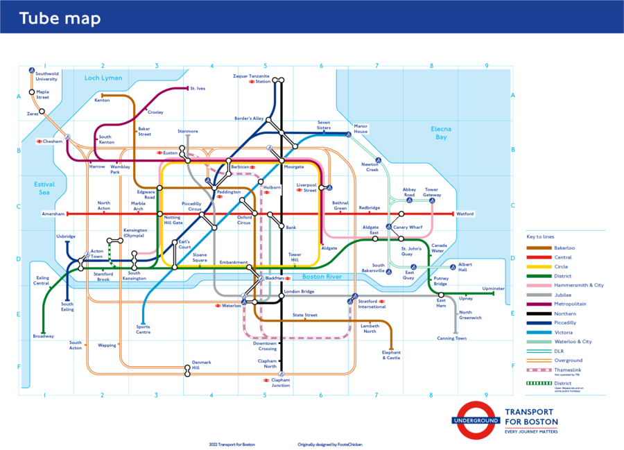
Latest Map
Boston Overground
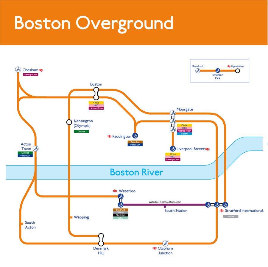
Boston Overground's official maps.
May 2019
September 2019
Latest Map
Docklands Light Railway
Docklands Light Railway's official maps.
MBTA Subway
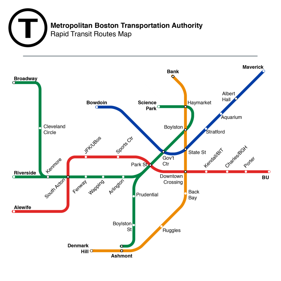
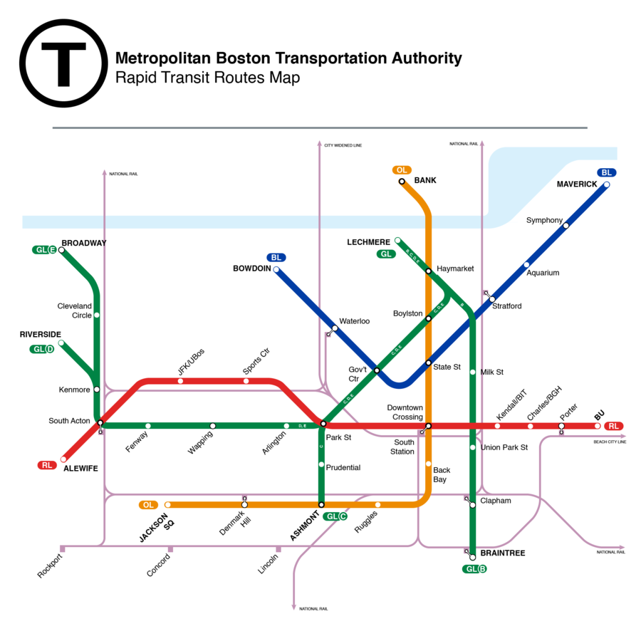
MBTA Subway's official maps.
May 2019
October 2019
Current Map
MBTA Commuter Rail
MBTA Commuter Rail's official maps.
