File:Savannastan Map.png
Jump to navigation
Jump to search


Size of this preview: 667 × 600 pixels. Other resolution: 726 × 653 pixels.
Original file (726 × 653 pixels, file size: 872 KB, MIME type: image/png)
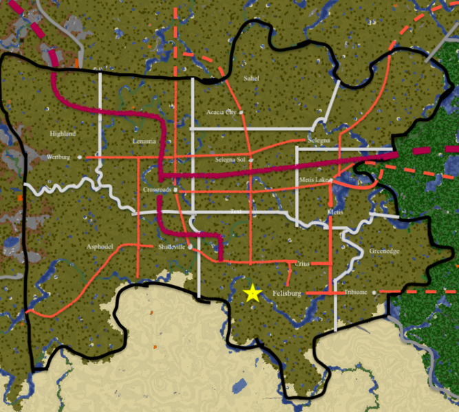
Map of Savannastan (1st edition) Note: May not be 100% accurate. Also, though I do note draw roads over county/city names, said roads still exist.
Key: Black=Savannastan State Borders Gray=Other State Borders Light Gray, almost White=County Borders Maroon=(Generally Planned) Interstate Dashed Maroon=Projected Out-of-state Road (Interstate) Orange=(Generally Planned) Other Major Road Dashed Orange=Projected Out=of-state Road (Other Major Road)
File history
Click on a date/time to view the file as it appeared at that time.
| Date/Time | Thumbnail | Dimensions | User | Comment | |
|---|---|---|---|---|---|
| current | 18:20, 23 August 2021 | | 726 × 653 (872 KB) | Toth 1 (talk | contribs) |
You cannot overwrite this file.
File usage
The following page uses this file: