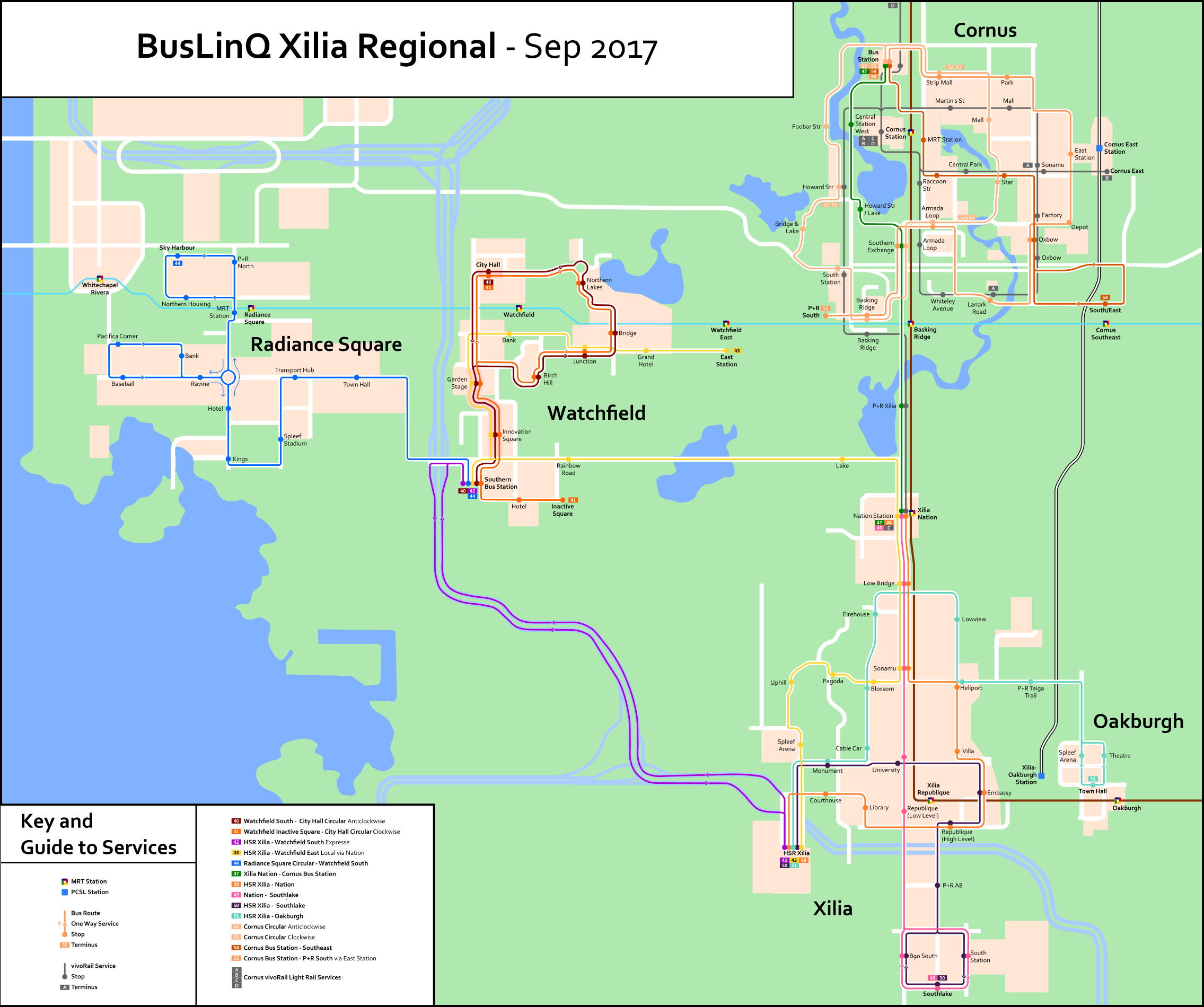
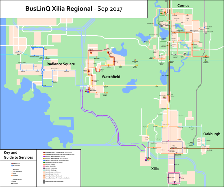
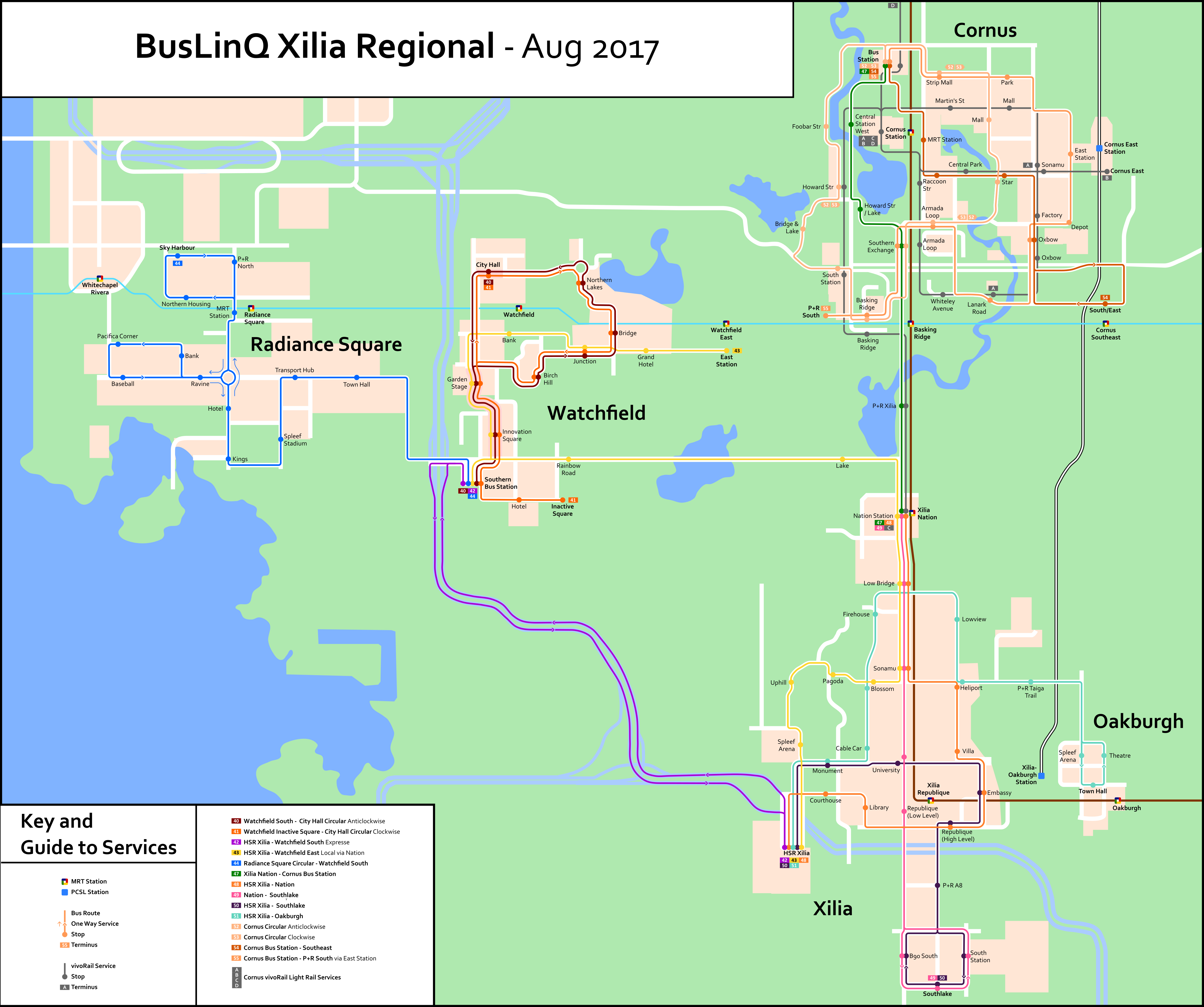
File:Xilia Regional bus network map.png
Jump to navigation
Jump to search

Size of this preview: 717 × 600 pixels. Other resolution: 2,271 × 1,900 pixels.
Original file (2,271 × 1,900 pixels, file size: 572 KB, MIME type: image/png)
File history
Click on a date/time to view the file as it appeared at that time.
| Date/Time | Thumbnail | Dimensions | User | Comment | |
|---|---|---|---|---|---|
| current | 18:00, 29 August 2017 | | 2,271 × 1,900 (572 KB) | AP Red (talk | contribs) | |
| 17:58, 29 August 2017 | Error creating thumbnail: File with dimensions greater than 12.5 MP | 4,999 × 4,182 (1.36 MB) | AP Red (talk | contribs) | ||
| 12:45, 26 August 2017 | 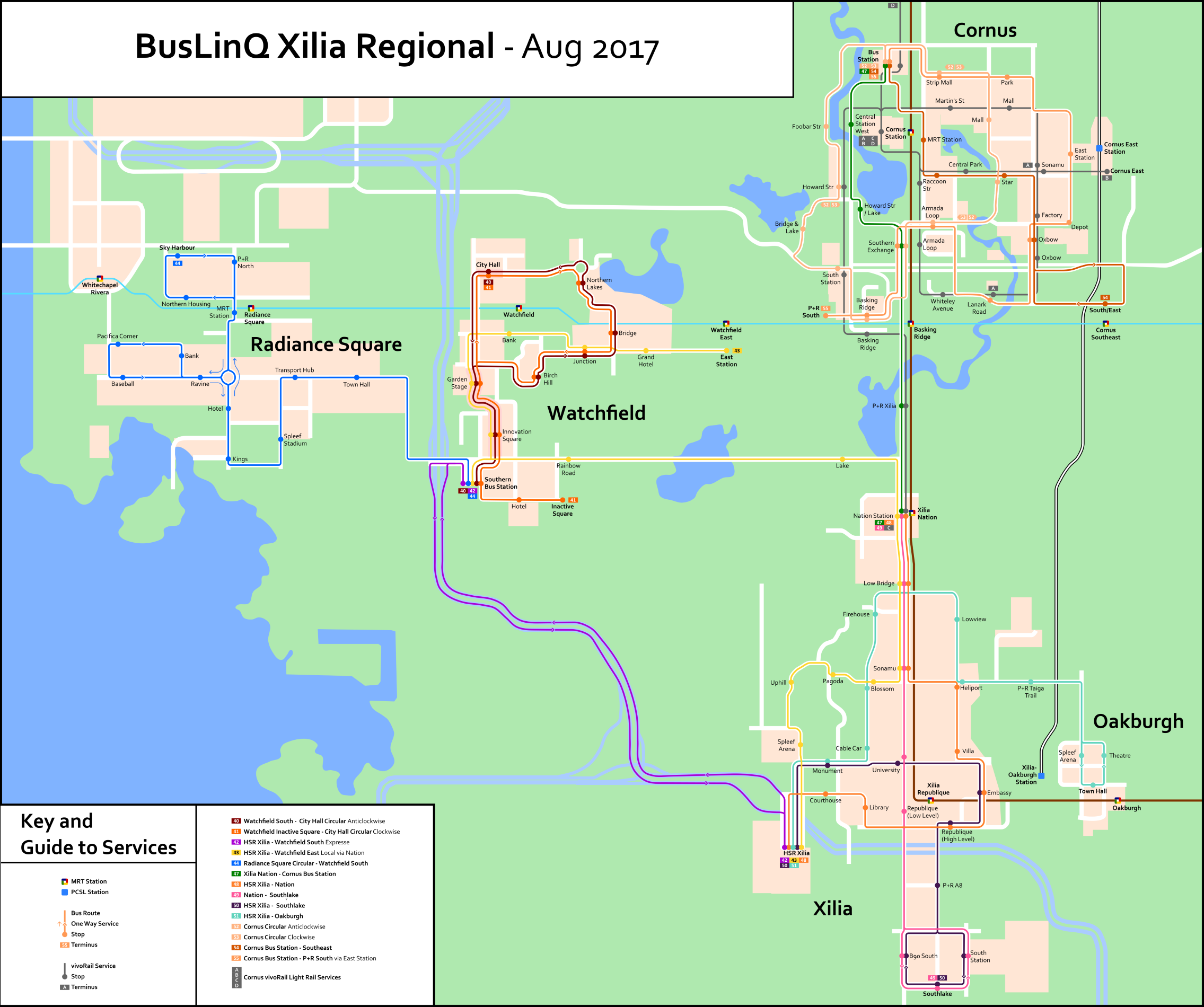 | 2,271 × 1,900 (543 KB) | Autobus (talk | contribs) | Map made by AP_Red | |
| 12:44, 26 August 2017 | Error creating thumbnail: File with dimensions greater than 12.5 MP | 4,999 × 4,182 (1.36 MB) | Autobus (talk | contribs) | ||
| 12:43, 26 August 2017 | Error creating thumbnail: File with dimensions greater than 12.5 MP | 4,999 × 4,182 (1.36 MB) | Autobus (talk | contribs) |
You cannot overwrite this file.
File usage
The following 2 pages use this file: