File:MRT TTC Subway Map.png
Jump to navigation
Jump to search


Size of this preview: 600 × 600 pixels. Other resolution: 1,600 × 1,600 pixels.
Original file (1,600 × 1,600 pixels, file size: 222 KB, MIME type: image/png)
Summary
Updated TTC subway map (OneNote).
File history
Click on a date/time to view the file as it appeared at that time.
| Date/Time | Thumbnail | Dimensions | User | Comment | |
|---|---|---|---|---|---|
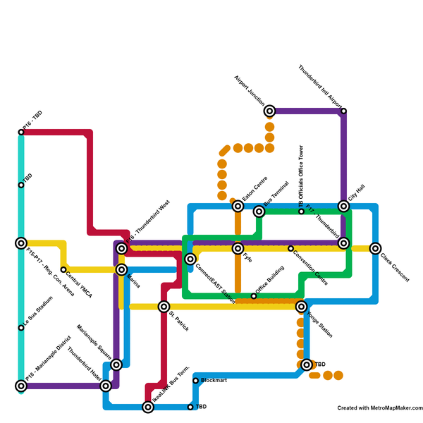
| current | 23:35, 20 January 2021 | | 1,600 × 1,600 (222 KB) | Decorminecraft (talk | contribs) | A new cyan line is planned to serve the west end of Thunderbird (mainly along the Plains line). The red line also has a projected path northwest of F16 station. |
| 04:27, 4 January 2021 | 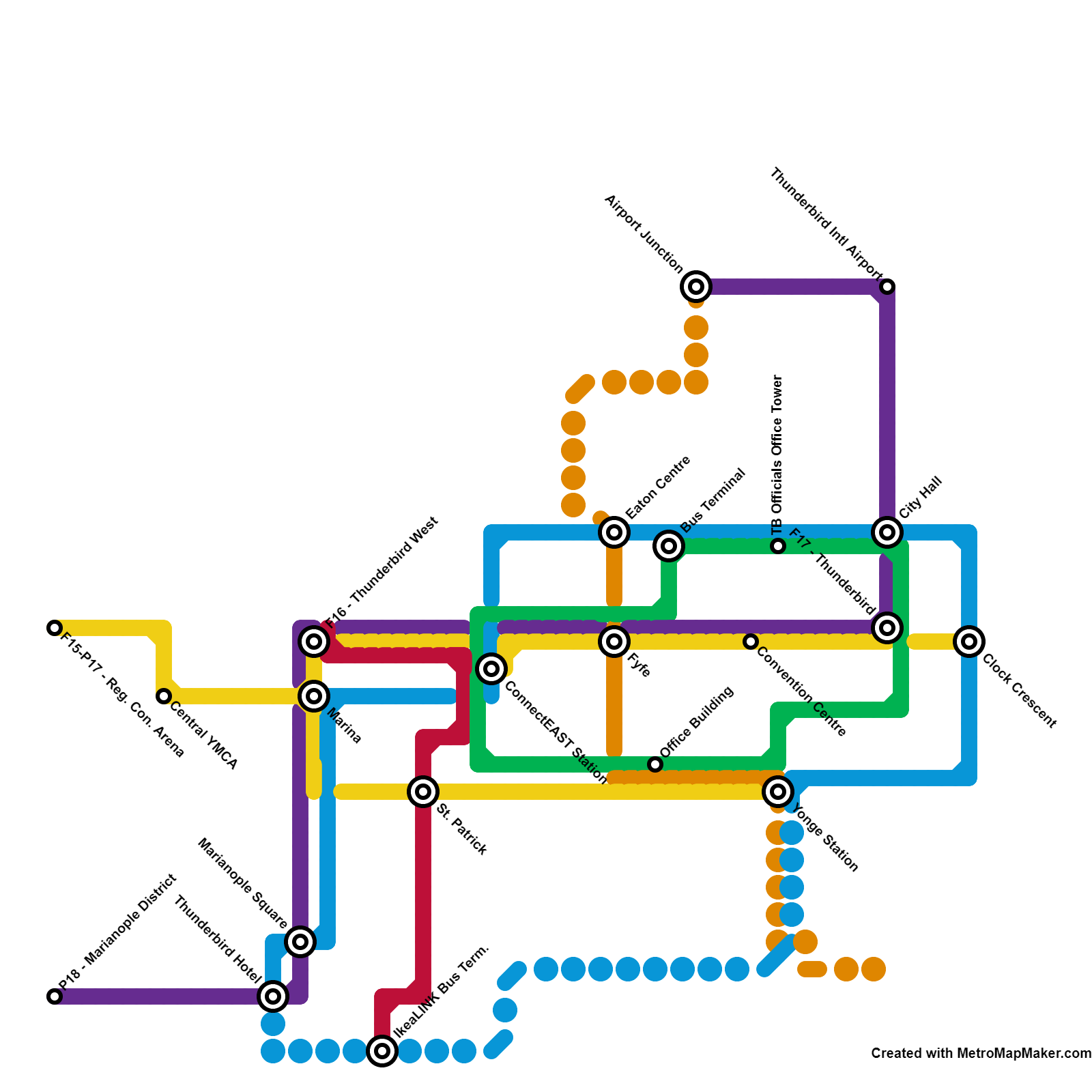 | 1,600 × 1,600 (205 KB) | Decorminecraft (talk | contribs) | Created with the use of metromapmaker.com. Updated TTC metro map and included some planned stretches represented by dotted lines. | |
| 20:28, 22 August 2019 | 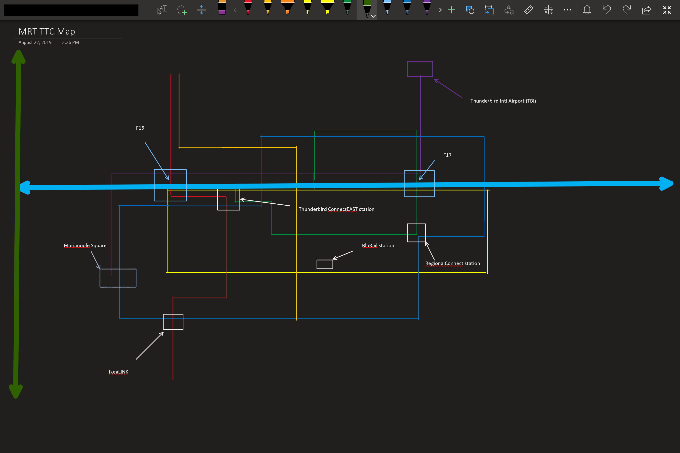 | 2,736 × 1,824 (110 KB) | Decorminecraft (talk | contribs) | Updated TTC subway map (OneNote). |
You cannot overwrite this file.
File usage
The following page uses this file: