B47
Jump to navigation
Jump to search
| B47 | |
|---|---|
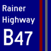
 Rainer Highway marker  Standard shield | |
| Route statistics | |
| Alternative names | Rainer Highway |
| Length | ~1.5 km (phase 1) |
| Route information | |
| Terminus 1 | Sycamore, Neverta |
| Terminus 2 | A440 (proposed) near Rainer Bay (when completed) |
| Status | |
| Contractors | |
| Planners | Spegit |
| Builders | Spegit, FredTheTimeLord, HarborRandom852, _7d, LondonThameslink, Seshpenguin, RedLemonFox, eurye |
The B47, also called the Rainer Highway, is a highway that travels from Sycamore, Neverta to Rainer Bay. Only phase one is built so far, from Sycamore to New Prubourne at the B46 and B460. Phase two is an extension to Rainer Bay via the planned A440.
Major intersections
| Status | Exit number | Destinations | Road designation | Notes |
|---|---|---|---|---|
| Continues into Sycamore as unnamed road | ||||
| 1 | Sycamore | Unnamed road | ||
| 1A | Downtown New Prubourne (under construction) | Crowfoot Boulevard | ||
| 2 | ||||
| 3 | Rattlerville/New Prubourne | |||
| 4 | Enterprise (planned) | Unnamed road | ||
| Leaves Meridia | ||||
| 1 | Rattlerville/Rainer Bay (planned) | A440 North, South | ||