Pixl
| Pixl | |
|---|---|
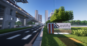 Downtown Pixl | |
 Flag of Pixl | |
| Officials | |
| Founder | Seshpenguin |
| Mayor | Seshpenguin |
| Deputy Mayor | EspiDev |
| Town recognition | |
| Rank | Governor |
| Date founded | April 3, 2016 |
| Date recognized as Councillor | June 19, 2017 |
| Date recognized as Mayor | July 24, 2017 |
| Date recognized as Senator | July 31, 2018 |
| Date recognized as Governor | July 4, 2023 |
| Geography | |
| Town hall coordinates | -5846, 67, 924 |
| World | New World |
| Ward(s) | Ward 7 |
| Transit | |
| MRT | C83 Pixl Central |
| Air facilities | Pixl Vinayaka City Airfield, Pixl Island International Airport |
| Rail facilities | Pixl Hub Transit Terminal |
| Water transit facilities | Pixl Bay Boat Terminal |
| Etymology | |
| Language(s) | English French Tamil Chinese Japanese |
Pixl is a Governor city founded and owned by Seshpenguin in 2016, located at C83 on the MRT Circle Line. Pixl has a modern building style and features road and transit systems. It is part of the Estify Region.
The Federal Government of Pixl is comprised of the single-tier municipalities of the City of Pixl, City of Dorval, and Sakura City, and federally owned territories.
History
Pixl was officially founded on April 3, 2016, a couple of days after Seshpenguin's unbanning. Beneath the Pixl-Cliotis region, there are remnants of a previous city from the beginning of Gamma, which has since been demolished. That city was approximately founded two years ago by Nano69, named Avult. The city was later taken over by Applearon, who renamed the city Kloyne. The town was then renamed Cliotis and later renamed Scyfil by Seshpenguin, following a recommendation by EspiDev. Seshpenguin later did major reconstruction and decided to name the city Pixl.
Pixl was promoted to Senator in July 2018 and was promoted to Governor on July 4, 2023.
On July 9, 2023, portions of the Estify and Iakuse river projects by Espil and Environment Pixl reached substantial completion, bounding Pixl with water on all sides, thus officially creating Pixl Island.
2021 governmental reorganization
In September 2021, the Government of Pixl voted for an overhaul of the governmental structure of the City. Before the reorganization, Pixl was a single unitary state, comprised of one level of government and comprising the entire area bounded from the lakeshore to A76, and Espil to Xandar-Vekta. This government also owned two territories, Dwarka and Rouge Valley.
The reorganization created a new entity, the Federal Government of Pixl. The previous Pixl region was split into two single-tier municipalities: the City of Pixl and the City of Dorval. Dwarka and Rouge Valley became territories of the new federal government.
Under the new system, the federal government and the municipalities are co-sovereign, that is they have powers and responsibilities split between them. For example, the federal government is responsible for transport (Transport Pixl), military (Pixlian Armed Forces), and environmental management (Environment Pixl). The municipalities are responsible for local infrastructure (electric, water, local roads, etc), health care, education, etc. Being co-sovereign, the municipalities have and elect their own government and leader (the Premier).
The two territories of Pixl are owned directly by the federal government and have powers devolved to them, thus bearing responsibilities similar to the municipalities, but without inherent sovereignty.
Geography
Pixl is located in the western New World, in Gamma in Ward 7. Pixl borders Lake 8, the Xandar-Vekta Canal, the Estify River, and the Iakuse River. Pixl is located in savannah, plains, and desert biomes.
Pixl has two direct neighbors, Espil and Xandar-Vekta. They are connected by many local roads and highways, including the B751, a number of public transport lines, and form a largely contiguous urban area. In relation to other nearby settlements, Evella is to the east.
Following the construction of the artificial Estify and Iakuse rivers, the majority of city's built up area formed a new island, Pixl Island.
Districts
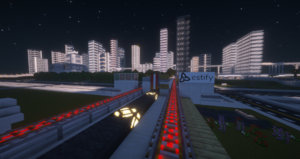
Pixl is split up into various districts. Each district provides various services.
- Clios - The Clios district consists of the former city of Cliotis and is the oldest region of Pixl. The Pixl-Clios district is encircled by Hwy-100, acting as the districts outer bounds, with the northern bound being Hwy-401/B752. Many of Pixl's oldest buildings were built here.
- Vilimpu - The Vilimpu district forms part of the south of Pixl along the Estify River, bordering city of Espil. This district covers a large part of Waterfront Pixl developments, and is the latest district to be defined.
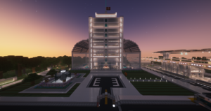
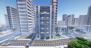
- Downtown Pixl - Downtown Pixl is towards the west and is the downtown core of Pixl, centered on Pixl-Lizi Rd. It is administrative and economic centre of Pixl and is home to many corporate offices, government buildings, and the Pixl City Hall.
- Yeri - This district comprises the area of the Pixl peninsula, east of the B751 highway. Pixl Vinayaka City Airfield and the Pixl Bay Boat Terminal stand out as the largest developments in this district.
- Narayana - Narayana (formerly Pixl North) is a lower-density residential district of Pixl, north of B752. The Sri Varasiththi Vinayaka Hindu Temple of Pixl is a defining part of the district.
Single-tier municipalities
Dorval
Dorval was a district of Pixl; however, it was spun off from the city during the 2021 governmental structure reorganization and became its own single-tier municipality.
Dorval is located on Pixl's east end. Compared to other regions of Pixl, Dorval is the francophone centre of Pixl and thus features prominent bilingual signage and French road names.
Dorval is also home to the University of Estify, the largest post-secondary educational institution in the Estify Region.
Sakura City
Sakura City (Japanese: 桜区) is a single-tier municipality within the Pixl Federal Government. Sakura City has Japanese-style influence and has Japanese as an official language, having signs in both English and Japanese. It is located at C84 station on the MRT Circle Line and centred on Sakura City station, the terminus of the Pixl Rail Grey Line.
Sakura City was created as part of an initiative with Xandar-Vekta. The city forms an area known as the Pixl-Xandar Joint Area, where Xandar enjoys co-development privileges within the city.
Major roads
Enili Corridor
The Enili Corridor is the area surrounding Enili Lane, a major east-west road roughly in the centre of Pixl, stretching from Pixl City Airfield to Pixl Hub. Much of Pixl's urban development has been centered on Enili Lane, forming a continuous and integrated urban area. Enili Corridor is not an official district, but rather spans multiple districts.
Genesis Avenue
Genesis Avenue is a major north-south road in Pixl, connected with the eponymously named Genesis Avenue in Espil. Genesis Avenue is a historically and culturally significant road in the Estify Region as it was the first road and structure built by Seshpenguin and EspiDev in front of C80 Station in 2015. In 2016, the first road in Pixl was built, which was built along the same Z-coordinate alignment as Genesis Avenue in Espil and shared the same name, with the intention of the two roads eventually connecting to form a single route. By 2018, the two roads had reached each other and officially became one.
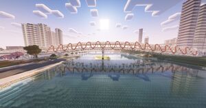
The Estify River - Genesis Ave Bridge is a two level bridge that connects Genesis Ave to Espil over the Estify River on the lower level, and additionally carries the MRT Circle Line and SkyTrain Grey Line on the upper level. It was constructed jointly by Transport Pixl and Espil Public Works. It is the largest bridge to cross the Estify River, and a major landmark in the area.
Transit
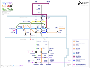
Transit in Pixl is owned and operated by Transport Pixl. It operates the Pixl Rail SkyTrain Network, local bus routes, airports, and roads in Pixl. Its corporate subsidiary, NextCorp operates the NextTrain service.
Pixl is also served by the Esti Mi Metro Network, where services in Pixl are be operated by Transport Pixl. Pixl is served by RaiLinQ, BluRail, IntraRail, and PMW Commuter.
Pixl Hub
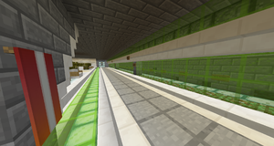
Pixl Hub is a major transportation hub in Pixl, located just east of MRT C83. Services include NextTrain, Esti Mi, BluRail, PMW Commuter, and various bus services.
Pixl Hub was announced by Transport Pixl on January 25, 2019, and construction then began shortly after. It is located in the block situated between Hwy-100, Redstone Rd, Hwy-404, and Hwy-110.
The rail station contains 5 tracks and 7 platforms, and the bus terminal contains 7 platforms.
Esti Mi (Metro)
Pixl is serviced by EstiNet's Esti Mi subway network, operated by Transport Pixl. The first line to be extended north from Espil was the Line 6 Avenue. This was followed by construction of Line 13 Enili, which forms a major east-west high capacity trunk along the Enili Corridor.
The Esti Mi network compliments Pixl's existing transit systems, such as the Pixl Rail SkyTrain service.
Pixl Rail SkyTrain
Pixl Rail SkyTrain is a rapid transit system serving Pixl, Espil, and Xandar-Vekta, consisting of high-frequency light metro lines along primarily elevated corridors. Originally operating as Pixl Rail in Pixl and Xandar, the system merged with Espil's SkyTrain system to form a joint network, similar in structure to the Esti Mi joint operation. After the merger, the network within Pixl and Xandar was renamed Pixl Rail SkyTrain.
Pixl Rail SkyTrain is the largest rapid transit system in Pixl, both by length and station.
Bus
Buses in Pixl are operated by Transport Pixl, with some routes running express into Espil. They serve local stops between rapid transit stations, or connect areas not yet served by higher order transit. Many routes originate or terminate at major bus hubs.
Routes
- 10 Enili (Pixl Vinayaka City Airfield - Pixl Hub)
- 10A Enili (Pixl Vinayaka City Airfield - Pixl Island International Airport)
- 11 EEA Express Network (Pixl Vinayaka City Airfield - Espil Ecilidae Airport)
- 20 Central City Express Network (Yoshi Rd. @ Enili Ln. - Global Affairs Pixl Central City HQ)
- 21 Unity (Pixl Vinayaka City Airfield - Pixl Hub)
- 21A Unity via Waterfront (Pixl Vinayaka City Airfield - Pixl Hub)
- 25 Temple (Temple Rd. @ Pixl-Lizi Rd. - Pixl Hub)
- 30 Vekta Express Network (Vekta South Station - Pixl Island International Airport via IntraSail Vekta Transfer)
- 40 Espil Sanders Intra Express Network (Genesis South - Espil Prime Bus Terminal)
Highways
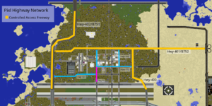
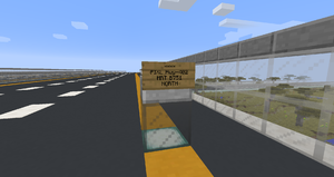
Transport Pixl is also responsible for Pixl's highway network, consisting of large controlled access freeways, and smaller regional highways (which differ from normal roads in Pixl in that they are maintained by Transport Pixl instead of the municipality and that they are designed with higher top speeds in mind). Pixl's controlled access freeways are numbered under the 400-series name. Even numbers are north/south routes, and odd are east/west.
Some of the highways in Pixl, including Highway 400, 401, and 402, are part of the larger New World highway network and are concurrently labeled with their A- or B-road naming counterparts. For example, the section of B751 that passes through Pixl is labeled concurrently as B71/Hwy-402. Another example is B752/Hwy-401, which is concurrently labeled with both its Pixl and MRT highway designation throughout its entire span.
Hwy-400
Pixl Highway 400 (part of the B753 Highway) is a north-south highway in Pixl's east end. It begins at the Pixl-Espil border to the south continuing as B753, interchanges with Hwy-401/B752, then the A76, and finally ends at the canal south of Xandar-Vekta border, where the highway continues north as the B753.
At its southern terminus, Hwy-400 continues as B753 into Espil, where it interchanges with B750 and B751, connecting to Espil Ecilidae Airport, and terminates at Waverly. At its northern terminus, Hwy-400 continues as B753 in Xandar, however, it is no longer a controlled-access highway. B753 terminates at Ilirea-7.
Hwy-401
Pixl Highway 401 (concurrently known as the B752) is a east-west highway and is Pixl's oldest and longest highway, not including B-class highways running into other cities. It terminates to the east at the A76, and to the west at Hwy-402/B71. The section of Hwy-401 between the Cliotis Region and Downtown Pixl was built before modern Pixl highway standards, resulting in the section having a speed limit of 90 km/h instead of the standard 100 km/h of the 400-class highways in Pixl.
Hwy-402
Pixl Highway 402 (part of the B751) is a north/south highway towards Pixl's west end. It begins at the Pixl-Espil border to the south, continuing as B751, and continues north to Xandar as B751.
Outside of Pixl, the B751 continues south into Espil where it interchanges with B750, turns east, runs through Espil Ecilidae Airport, interchanges with B753, and terminates at the A76. Hwy-402/B751 also continues north of Pixl, where it enters Xandar, then terminates at the A78.
Air transport
On July 31, 2018, Transport Pixl announced the immediate construction of Terminal 1 of the Pixl Vinayaka Airport. It is a senator airfield located on the west end of Pixl.
On April 6, 2024, Transport Pixl and the Estify Airports Authority opened Pixl Island International Airport, a governor airport on the east end of Pixl.
Healthcare
Healthcare is administered by Health Pixl, which provides the publicly funded single-payer healthcare and pharmacare system in Pixl. Health Pixl builds and operates the hospitals in Pixl, which are part of the Estify Health Network.
Pixl General Hospital
The Pixl General Hospital is a major teaching hospital in the Estify Health Network, affiliated with the Koudo Ikusei University. It is located in Downtown Pixl adjacent to Bridge Station on the Lizi SkyTrain line. The hospital has two wings, the E. Dev ED Building (A Wing), and the S. Penguin Tower (B Wing).
Centre for Addiction, Mental Health, and Gender
The Centre for Addiction, Mental Health, and Gender (CAMHG) is a psychiatric teaching hospital in Pixl. It is the first and largest dedicated mental health hospital in the Estify Region. It provides a range of distinct clinical services across inpatient, outpatient, day treatment, and partial hospitalization needs. CAMHG is located near the Pixl Waterfront at Parliament Station on the Lizi SkyTrain line.
Tourism and recreation
TourismPixl is the government department responsible for two key sectors: the external marketing of Pixl and the development of recreational attractions in Pixl. Overall, TourismPixl is tasked with curating a unified vision of leisure and recreation across Pixl, balancing the longstanding focus of building purely functional housing and business areas.
In August 2023, TourismPixl formed a small team dubbed the TAR Attractions Initiative Board, with the goal of researching and executing a strategy to see Pixl as an inviting venue for game shows. This includes constructing and documenting specialized and multi-purpose attractions across the city. The board will consider its goal complete when Pixl is featured in The Amazing Race, a large game show that has seen Pixl as the only city in the Estify Region unfeatured.
Notable attractions
Notable attractions in Pixl include:
- piff NEXT Lightbox – A theater located in Pixl's entertainment district with two cinemas and rentable venue spaces. Home to the Pixl International Film Festival.
- Sri Varasiththi Vinayaka Hindu Temple of Pixl – A large temple in the north of Pixl with shrines to various Hindu gods
- Estify SC Pixl Spleef Arena – One of the first large-scale builds in Downtown Pixl
- Kadhal Park – Park located on the Pixl Waterfront, adjacent to Illainir Community Centre
- Koudo Ikusei University – The first university established in the Estify Region, and is located in Downtown Pixl
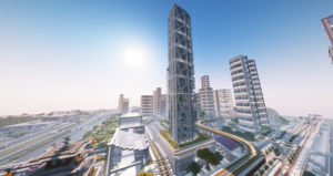
- Pixl General Hospital – A major teaching Hospital, part of the Estify Health Network. The hospitals B Wing, the S. Penguin Tower, is the tallest skyscraper in Pixl.
Sports
Estify SC is Pixl's spleef club. Pixl is home to the Pixl Spleef Arena.
A Forest Mini-Golf venue has been built in Dorval, on the east-end of Pixl Island.
Media
The Government of Pixl runs the Pixl Broadcasting Corporation. The PBC is a crown corporation that runs various television and radio channels, both locally in Pixl and to other regions of the MRT.
Intercity affairs
The department of Global Affairs works to expand Pixl's global presence, and facilities the growth and expansion of cities across the MRT.
Global Affairs Pixl (GAP) has its main headquarters in Central City, due to its ease of access and neutral location. GAP also has an office building in Downtown Pixl, and offices in the Pixl Global Outreach Centre.
Pixl is a part of the Southwestern Allied Territories and is in the Estify Region.
Border security
The Pixl Border Services Agency (PBSA) is the government agency responsible for border enforcement, immigration enforcement, and customs services. As the national security threat to Pixl is quite low, the Government of Pixl and PBSA opts to keep a fairly relaxed border security policy.
As of early 2019, the Pixl Border Services Agency changed its tactics regarding border security. All traditional border crossings, road and rail, have been retired in favour of new security strategies.

