A5
| Information | |
|---|---|
| Planner | Narnia17 time2makemymove autobus |
| Constructor | Narnia17 autobus |
| Helpers | MinecraftYoshi26 jphgolf4321 AP_Red Powerminer01 time2makemymove |
| Terminus North | |
| Terminus South | |
| Status | |
| Road Status | |
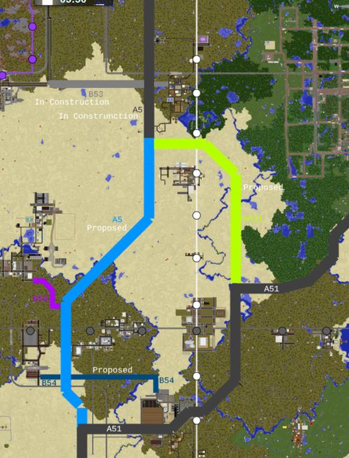
The A5 is an A-class highway on the New World that connects the Southwold Region (Whiteley, Venceslo, Schillerton) to Central City via Segville.
2018/2019 Realignment Projects
In early 2018, a realignment plan of the ![]() , penned by autobus22 and time2makemymove was submitted and confirmed to extend the road to Whiteley and Venceslo. As such, the previous alignment that curved toward Utopia was renumbered as the
, penned by autobus22 and time2makemymove was submitted and confirmed to extend the road to Whiteley and Venceslo. As such, the previous alignment that curved toward Utopia was renumbered as the ![]() from Shady Grove to Utopia, to account for the
from Shady Grove to Utopia, to account for the ![]() 's extension southward.
's extension southward.
In May of 2019, another realignment plan was proposed to reroute the A5's northern terminus from the existing at-grade intersection with Morningside Avenue to an existing unused interchange at Eisitasi Avenue built by suppoe, passing by Bluegrass (ZS3) in the process.
Almost a year and a half after the first plan was originally discussed, both realignment projects were finally completed in July 2019, by autobus22, Narnia17, and time2makemymove. Signage on the new extension was done by time2makemymove.
| Status | Exit number | Destinations | Road designation | Notes |
|---|---|---|---|---|
| 0a | Central City Southwest Terminal | |||
| 0b | Central City | |||
| 1a | B450 to Sealane, Formosa, Royal Ferry, Greenmount | |||
| 1b | Junction |
|||
| 2a | Pieville | |||
| 2b | A5-W Danielston | A5-W | ||
| 3 | Segville | |||
| 3e | Segville Airport Access (Only Northbound) | |||
| 4 | Junction |
|||
| 5 | Shady Grove (planned) | |||
| 6 | East End (planned) | |||
| 7 | Junction |
|||
| 8 | Delta City North (planned) | |||
| 9 | Delta City South (planned) | |||
| 10 | unknown city at ZS14 (under construction) | |||
| 11 | ||||
| 12 | unnamed roundabout to Itomori, Mallison, Paixton (under construction) | B56 | ||
| 13 | ||||
| 14 | Junction |
|
